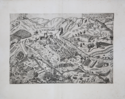
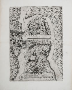
IL VERO DISEGNO DI VICOVARO OCCUPATO DA IMPERIALI ET RECUPERATO...
Sebastiano dal Re
Code:
S38098
Measures:
387 x 270 mm
Year:
1557 ca.
Printed:
Rome
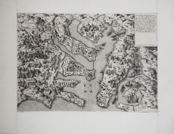
Li porti dell’Isola di Malta con la Pianta della nova Cittade dove...
Nicolas Beatrizet detto BEATRICETTO
Code:
S29756
Measures:
415 x 282 mm
Year:
1558 ca.
Printed:
Rome
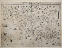
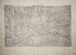
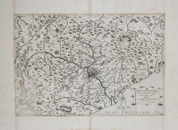
LA TOSCANA - Tusciae elegantioris Italiae partis...
Antonio SALAMANCA
Code:
CO-379
Measures:
530 x 390 mm
Year:
1558 ca.
Printed:
Venice
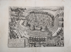
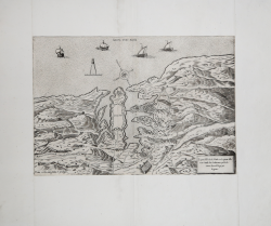
Thionville
Nicolas Beatrizet detto BEATRICETTO
Code:
S40845
Measures:
425 x 310 mm
Year:
1558
Printed:
Rome
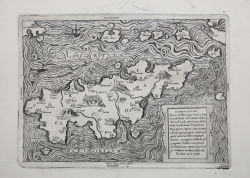
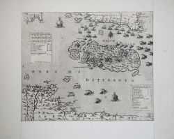
Candido lectori. Haec est illa insignis insula Creta: in medio...
Francesco & Michele TRAMEZINO o TRAMEZINI
Code:
S29752
Measures:
315 x 220 mm
Year:
1559
Printed:
Rome

Exactissima Flandriae Descriptio
Giovanni Francesco CAMOCIO
Code:
S26653
Measures:
503 x 420 mm
Year:
1559
Printed:
Venice
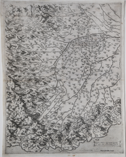
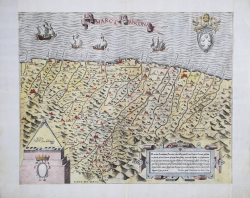
Regionis subalpinae vulgo Piemonte appellatae discriptio, aeneis...
Antonio LAFRERI
Code:
S1651
Measures:
400 x 505 mm
Year:
1560 ca.
Printed:
Rome
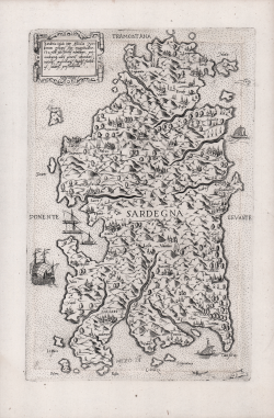
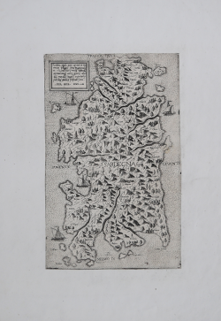
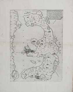
Sardinia jnsula inter africu[m] et tirrenum pelagus sita...
Ferrando BERTELLI
Code:
s30329
Measures:
185 x 298 mm
Year:
1562
Printed:
Venice
Nova Discrittione di Tutto il Territorio de Roma. In Venetia M.D.LXIII
Ferrando BERTELLI
Code:
S29166
Measures:
460 x 312 mm
Year:
1563
Printed:
Venice
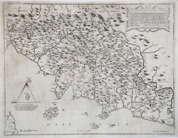
Descrittione di Tutta la Toscana fatta da M. Hier.mo Bell'armato
Ferrando BERTELLI
Code:
CO-383
Measures:
445 x 320 mm
Year:
1563
Printed:
Venice
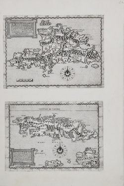
L’Isola Spagnola - L’Isola Cuba
Paolo FORLANI
Code:
S27086
Measures:
188 x 258 mm
Year:
1564
Printed:
Venice
Vogliono alcuni che l'isola di Corfù fosse prima da Sisito latrone...
Paolo FORLANI
Code:
S30341
Measures:
280 x 376 mm
Year:
1564
Printed:
Venice
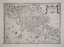
En candidi Lectores, elegantioris Italiae partis, Tusciae scilicet...
Antonio LAFRERI
Code:
CO-080
Measures:
495 x 385 mm
Year:
1564 ca.
Printed:
Rome
Nuovo disegno dell’Isola di Malta et suoi forti Con li Isola di...
Antonio LAFRERI
Code:
S29755
Measures:
450 x 377 mm
Year:
1565
Printed:
Rome
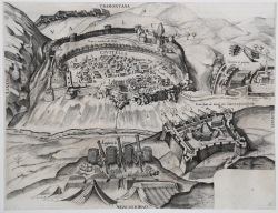
Tocquay, over Doggey, fortezza inespugabile ne Confini d'Ongheria &...
Domenico ZENOI
Code:
s30344
Measures:
300 x 410 mm
Year:
1565
Printed:
Venice
Ultimo disegno delli forti di Malta venuto nuovamente
Antonio LAFRERI
Code:
S29757
Measures:
510 x 535 mm
Year:
1565
Printed:
Rome