
- New
| Reference: | S31428 |
| Author | Giovanni Maria CASSINI |
| Year: | 1788 |
| Zone: | Balkans |
| Printed: | Rome |
| Measures: | 680 x 1410 mm |
| Reference: | S31428 |
| Author | Giovanni Maria CASSINI |
| Year: | 1788 |
| Zone: | Balkans |
| Printed: | Rome |
| Measures: | 680 x 1410 mm |
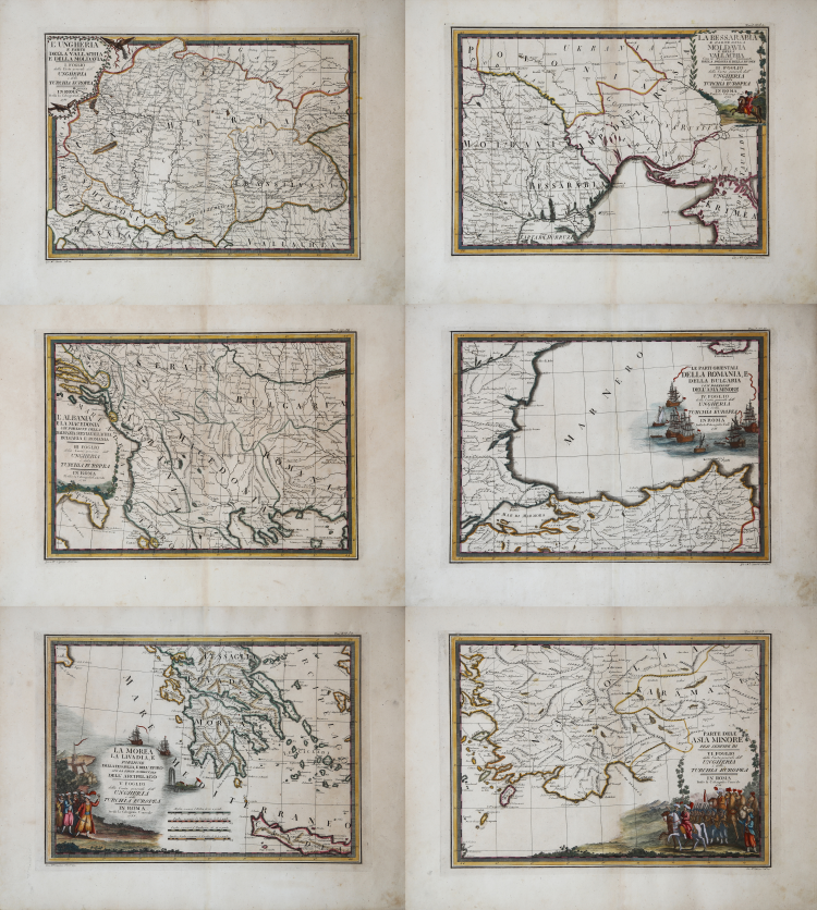
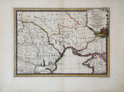
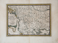
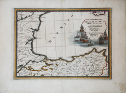
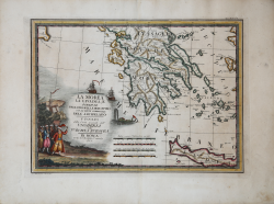
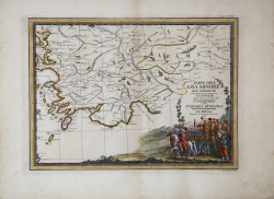
An important and decorative wall map (six sheets still to be joined) of the Balkans, taken from the “Nuovo Atlante Geografico Universale delineato sulle ultime osservazioni” published in Rome from 1792 to 1801. The work, commissioned by Calcografia Camerale from Giovanni Maria Cassini, was intended to replace the now obsolete "Mercurio Geografico" by De Rossi.
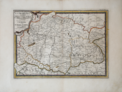
This detailed map, published in 1788, depicts regions of Hungary, Wallachia, Moldavia, and parts of the European territories of the Ottoman Empire. Entitled “L'Ungheria e parte della Valacchia e della Moldavia", it illustrates the geopolitical of Eastern Europe at the end of the 18th century. The map, engraved and published by Calcografia Camerale in Rome, measures approximately 141 cm wide and 68 cm high (when mounted), with a scale of 1:300,000.
The Cassini Map is a remarkable example of late 18th-century cartography, combining artistic decoration with precise geographical representation. It features elaborate decorative cartouches on each of the six sheets, reflecting the Baroque style prevalent during Cassini's time. The cartouches are embellished with classical imagery, reflecting Cassini's training under the renowned Giambattista Piranesi, known for his ability to combine classical architecture with Baroque elements.
The subject focuses on the political boundaries and major regions of Eastern Europe, highlighting areas under the influence or control of the Ottoman Empire, as well as neighboring territories such as Poland and Russia. This reflects the complex political landscape of the time, characterized by shifting borders and the decline of Ottoman power in Europe.
Giovanni Maria Cassini was a geographer and cartographer, but also an engraver of architecture and perspective - one of Giovanni Battista Piranesi's best disciples. Cassini was one of the last Italian spherographers of the 18th century, and his globes enjoyed considerable circulation, as did the “Nuovo Atlante Geografico Universale”. Cassini's Atlas was reprinted by the Calcografia Camerale in the first quarter of the 19th century, before 1839. Only first-edition copies, like this one, are printed on contemporary laid paper and are hand-colored at the time. The 19th-century editions were already on mechanical paper, without laid paper, and generally in black and white.
Etching, contemporary coloring with retouching, in excellent condition.
For a complete copy of the map, please consult the Rumsey Collection.
Giovanni Maria CASSINI (1745 - 1824)
|
Giovanni Maria Cassini was a fine Italian engraver, globe maker and painter. He did most of his work in Rome, and was not a member of the French Cassini family (a French Giovanni Maria Cassini was bor 120 years earlier). In 1792 Cassini published in Rome Vol. 1 of his atlas Nuovo Atlante Geografico Universale. This contained two celestial hemispheres printed in 1790, which were labeled Planisfero Celeste Settentrionale and Meridionale. Similar to Zatta's hemispheric prints, in the corners were beautiful drawings of famous observatories: Collegio Romano, Bologna, Milan and Padua in the northern plate, and Paris, Cassel, Greenwich and Copenaghen in the southern plate. Vol. 2 of this atlas was published in 1797, Vol. 3 in 1801.
|
Giovanni Maria CASSINI (1745 - 1824)
|
Giovanni Maria Cassini was a fine Italian engraver, globe maker and painter. He did most of his work in Rome, and was not a member of the French Cassini family (a French Giovanni Maria Cassini was bor 120 years earlier). In 1792 Cassini published in Rome Vol. 1 of his atlas Nuovo Atlante Geografico Universale. This contained two celestial hemispheres printed in 1790, which were labeled Planisfero Celeste Settentrionale and Meridionale. Similar to Zatta's hemispheric prints, in the corners were beautiful drawings of famous observatories: Collegio Romano, Bologna, Milan and Padua in the northern plate, and Paris, Cassel, Greenwich and Copenaghen in the southern plate. Vol. 2 of this atlas was published in 1797, Vol. 3 in 1801.
|