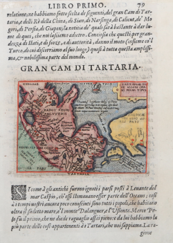
Tartariae sive magni Chamu regni typus Abraham ORTELIUS - Philip GALLE Code: S33916 Measures: 110 x 80 mm Year: 1577 Printed: Antwerpen Price €250.00 Quick view View Details
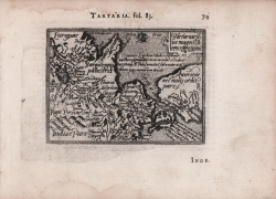
Tartaria sive Magni Chami Regni Typus Pietro Maria MARCHETTI Code: S13396 Measures: 110 x 80 mm Year: 1598 ca. Printed: Brescia Price €175.00 Quick view View Details
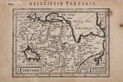
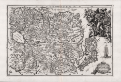
Tartaria Jodocus HONDIUS Jr. Code: MS1878 Measures: 135 x 96 mm Year: 1616 Printed: Amsterdam Price €125.00 Quick view View Details
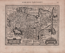
Tartaria Johannes JANSSONIUS Code: S48188 Measures: 182 x 137 mm Year: 1628 ca. Printed: Amsterdam Price €180.00 Quick view View Details
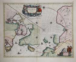
Nova et Accvrata Poli Artici et Terrarum Circum Iacentium Descriptio Johannes JANSSONIUS Code: W12762 Measures: 540 x 420 mm Year: 1637 ca. Printed: Amsterdam Price €1,000.00 Quick view View Details
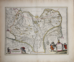
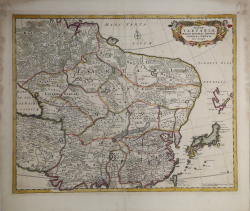
Tartaria sive Magni Chami Imperivm Johannes JANSSONIUS Code: mms1027 Measures: 510 x 490 mm Year: 1640 ca. Printed: Amsterdam Price €450.00 Quick view View Details
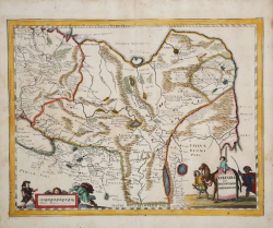
Tartaria sive magnichami Imperiorum Matthaus MERIAN "il vecchio" Code: S4591 Measures: 355 x 270 mm Year: 1640 ca. Printed: Frankfurt Price €280.00 Quick view View Details
Description de la Tartarie... Nicolas SANSON Code: S40127 Measures: 575 x 360 mm Year: 1654 Printed: Paris Price €300.00 Quick view View Details
Magnae Tartariae, Magni Mogolis Imperii Iaponia et Chinae Nova... Frederick de WIT Code: S4894 Measures: 555 x 440 mm Year: 1680 ca. Printed: Amsterdam Price €600.00 Quick view View Details
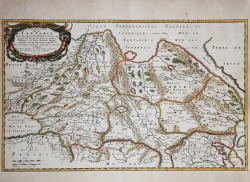
Totius Tartariae nova descriptio geographica Anno 1700 Henrick SCHERER Code: s34946 Measures: 357 x 240 mm Year: 1700 Printed: Munich Price €450.00 Quick view View Details
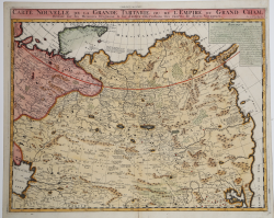
Carte Nouvelle de la Grande Tartarie ou de L'Empire du Grand Cham Henri Abraham CHATELAIN Code: ms1237 Measures: 510 x 405 mm Year: 1708 ca. Printed: Amsterdam Price €180.00 Quick view View Details
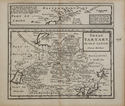
Great Tartary, the Isle of Iapon Herman MOLL Code: ms5864 Measures: 107 x 170 mm Year: 1720 ca. Printed: London Price €100.00 Quick view View Details
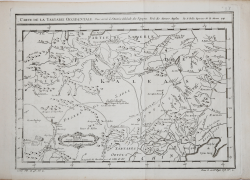
Suite de la Carte de La Siberie Et le Pays de Kamtschatka Jacques Nicolas BELLIN Code: S20731 Measures: 275 x 275 mm Year: 1757 ca. Printed: Paris Price €100.00 Quick view View Details
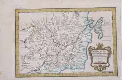
Carte De La Tartarie Orientale… Jacques Nicolas BELLIN Code: S20732 Measures: 326 x 220 mm Year: 1757 Printed: Amsterdam Price €100.00 Quick view View Details
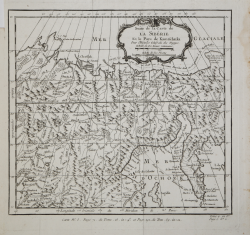
Carte de la Tartarie Occidentale… Jacques Nicolas BELLIN Code: S20729 Measures: 325 x 240 mm Year: 1757 ca. Printed: Paris Price €100.00 Quick view View Details
Carte des Isle Kouriles dapres la Carte Russe Jacques Nicolas BELLIN Code: S20730 Measures: 290 x 260 mm Year: 1757 ca. Printed: Paris Price €100.00 Quick view View Details
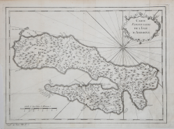
Carte Particuliere de l'Isle d'Amboine Jacques Nicolas BELLIN Code: MS4415 Measures: 310 x 230 mm Year: 1757 ca. Printed: Paris Price €100.00 Quick view View Details
Carte Géographique et Minéralogique de la Route de Brest a Paris et... Jean-Baptiste Chappe d'Auteroche Code: S42718 Measures: - x - mm Year: 1761 Printed: Paris Price €1,500.00 Quick view View Details
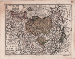
Imperium Russicum omnisque Tartaria Tobias Conrad LOTTER Code: S4429 Measures: 127 x 105 mm Year: 1762 ca. Printed: Ausburg Price €100.00 Quick view View Details
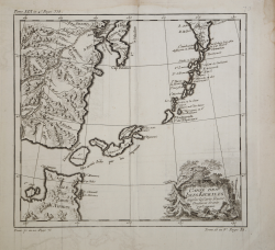
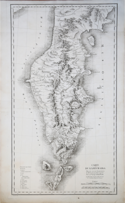
Carte du Kamtchatka Jean-Baptiste Chappe d'Auteroche Code: S42719 Measures: 490 x 860 mm Year: 1768 Printed: Paris Price €575.00 Quick view View Details