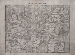
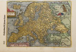
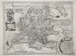
La Carte & description d'Europe
Antoine Du PINET
Code:
s21467
Measures:
335 x 260 mm
Year:
1564
Printed:
Lyon
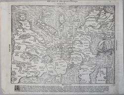
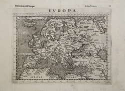
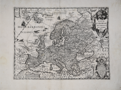
La Carte d'Europe
Francois de BELLEFOREST
Code:
MS3227
Measures:
470 x 245 mm
Year:
1575
Printed:
Paris
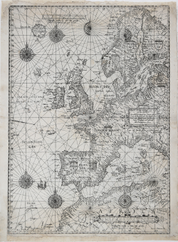
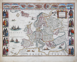
Universe Europe maritime eiusque navigationis descriptio
Lucas Janszoon WAGHENAER
Code:
S49655
Measures:
395 x 555 mm
Year:
1583 ca.
Printed:
Leyden
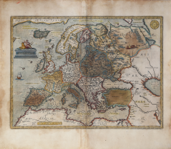
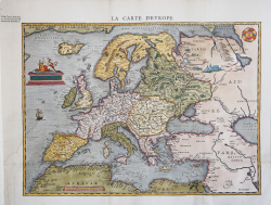
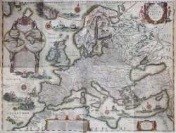
Europa recens descripta à Guilielmo Blaeuw
Willem Janszoon BLAEU
Code:
A48073
Measures:
565 x 415 mm
Year:
1617 ca.
Printed:
Amsterdam
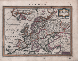
Nova Europa Descriptio
Justus SADELER
Code:
S38704
Measures:
465 x 355 mm
Year:
1619
Printed:
Venice
NOVA TOTIUS EUROPAE TABULA AUCTORE IOANNES BLAEU
Goert van SCHAYCK
Code:
MS3436
Measures:
1110 x 830 mm
Year:
1627 ca.
Printed:
Rome
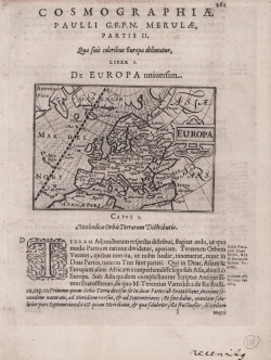
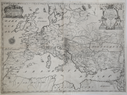
Europae Nova Tabula
Johannes JANSSONIUS
Code:
S48106
Measures:
205 x 145 mm
Year:
1628 ca.
Printed:
Amsterdam
Universalis 46 provinciarum Ordinis ff. Minorum Capucinorum per...
Johannes MONTECALERIO
Code:
s30652
Measures:
675 x 495 mm
Year:
1649 ca.
Printed:
Turin
Europa Uyt gegeven door Lowys Vlasbloem 't Amsterdam
Louis Vlasbloem
Code:
VR09OL
Measures:
254 x 178 mm
Year:
1656 ca.
Printed:
Amsterdam
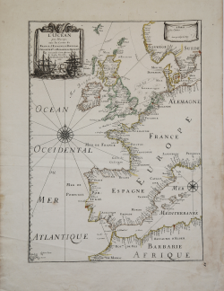
L'Ocean pres d'Europe avec les Costes de France, d'Espagne, de...
Pierre DUVAL
Code:
VR54FR
Measures:
340 x 470 mm
Year:
1666
Printed:
Paris
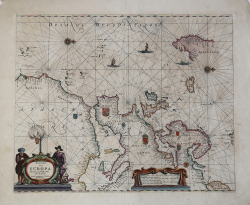
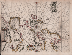
Pascaart van Europa, Als mede een gedeelt vande cust von Africa
Pieter GOOS
Code:
VR11OL
Measures:
525 x 430 mm
Year:
1666
Printed:
Amsterdam
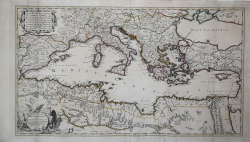
A New Map of the Mediterranean Sea
John OVERTON
Code:
GR3041
Measures:
860 x 500 mm
Year:
1670 ca.
Printed:
London
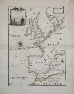
L'Ocean pres d'Europe avec les Costes de France, d'Espagne, de...
Pierre DUVAL
Code:
VR55FR
Measures:
340 x 470 mm
Year:
1677
Printed:
Paris
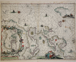
[Carta nautica di Europa e Mediterraneo]
Huych ALLARD
Code:
VR13OL
Measures:
605 x 475 mm
Year:
1680 ca.
Printed:
Amsterdam