| Reference: | VR09OL |
| Author | Louis Vlasbloem |
| Year: | 1656 ca. |
| Zone: | Europe |
| Printed: | Amsterdam |
| Measures: | 254 x 178 mm |
| Reference: | VR09OL |
| Author | Louis Vlasbloem |
| Year: | 1656 ca. |
| Zone: | Europe |
| Printed: | Amsterdam |
| Measures: | 254 x 178 mm |
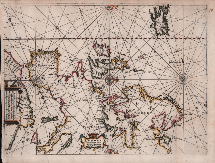
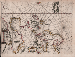
Etching and engraving, 254x178mm, signed in the lower centre cartouche. Magnificient example, original colors, in perfect condition.
Extremely rare sea chart of the foma; approach to Amsterdam by sea from the North, beginning with the southern part of Vrieslant and West Vrieslandt, passing the towns of Taveren, Enckusen and Hoorn and finally to Amsterdam in the South. showing the final part of the crossing from England and the British Isles to Amsterdam from the North Sea, published by Louis Vlasbloem in Amsterdam.
Vlasbloem's published several books of Sea Charts for the Dutch and English Markets, from about 1646 to 1660. His works were available to and apparently heavily used by common mariners working the seas between Holland and the Bitish Isles, asall of his works are extremely rare and most survive in various states of damage and disrepair. For example, there are only 3 or 4 known examples of his North Zea . . . , none of which is complete.
It is possible that the present map was included in Vlasbloem's Nieuwe lees-kaert, dat is de westersche schipvaert, ofte loots-mans wegh-wijser, inhoudende; alle de zee-custen van de Zuyder-Zee, Hollandt, Zeelandt, ... However, because most of his works are known in only 1 or 2 examples, it is not possible to know the appearnces of each of the maps.
The only complete copy of the first edition is the one kept at the University Library of Leiden, while a later variant is known at the Rotterdam Maritime Museum. Other examples, not complete, are those of the Library of Congress and the British Library.
Bibliografia: C. Koeman, Atlantes Neerlandici: Bibliography of Terrestrial, Maritime and Celestial Atlases and Pilot Books Published in the Netherlands up to 1880 Vol. IV, Amsterdam 1970, pp. 460-462, Vl 4 (1); cfr. R. Shirley, Maps in the Atlases of the British Library, Londra, 2004, p. 1315.
|
S. Bifolco, "Mare Nostrum, Cartografia nautica a stampa del Mar Mediterraneo" (2020), p. 104, tav. 37.
|
Louis Vlasbloem(attivo ad Amsterdam alla metà del XVII secolo)
|
S. Bifolco, "Mare Nostrum, Cartografia nautica a stampa del Mar Mediterraneo" (2020), p. 104, tav. 37.
|
Louis Vlasbloem(attivo ad Amsterdam alla metà del XVII secolo)