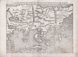
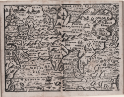
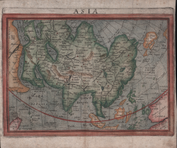
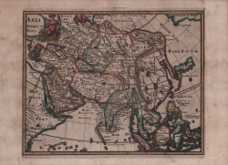
Tavola della oriental regione dell' Asia, che comprende l'estreme... Sebastian Münster Code: S35574 Measures: 335 x 270 mm Year: 1540 ca. Printed: Basle Price €1,100.00 Quick view View Details
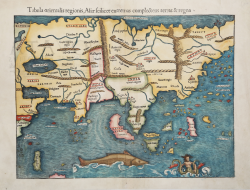
Tabula orientalis regionis, Asiae feilicet extremas compleetens... Sebastian Münster Code: S42553 Measures: 400 x 300 mm Year: 1540 ca. Printed: Basle Price €1,250.00 Quick view View Details
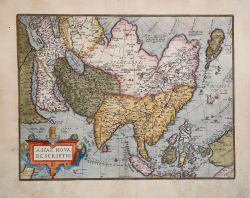
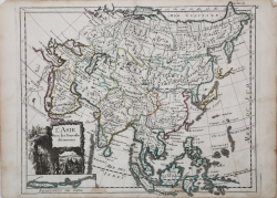
Asiae Nova Descriptio Abraham ORTELIUS Code: S34873 Measures: 490 x 375 mm Year: 1574 ca. Printed: Antwerpen Price €1,300.00 Quick view View Details
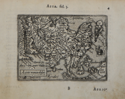
Asiae nova descr(iptio) Abraham ORTELIUS - Philip GALLE Code: s33910 Measures: 107 x 80 mm Year: 1577 ca. Printed: Antwerpen Price €250.00 Quick view View Details
(Asia) Giuseppe ROSACCIO Code: MMS2753 Measures: 170 x 130 mm Year: 1594 ca. Printed: Venice Price €350.00 Quick view View Details
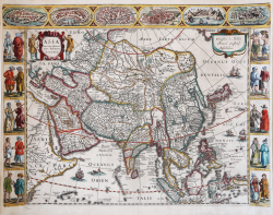
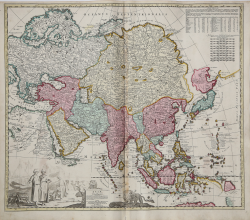
Asia recens summa cura delineata Jodocus HONDIUS Jr. Code: MS7574 Measures: 555 x 410 mm Year: 1623 ca. Printed: Amsterdam Price €3,000.00 Quick view View Details
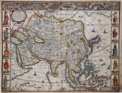
Asia with the Islands adioyning described.. John SPEED Code: S36303 Measures: 510 x 390 mm Year: 1626 ca. Printed: London Price €2,500.00 Quick view View Details
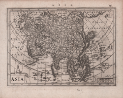
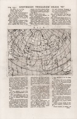
Asia Johannes JANSSONIUS Code: S48179 Measures: 204 x 145 mm Year: 1628 ca. Printed: Amsterdam Price €225.00 Quick view View Details
Asia Lucantonio GIUNTI Code: MS5342 Measures: 250 x 190 mm Year: 1640 Printed: Venice Price €450.00 Quick view View Details
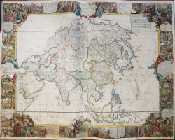
L' Asia Nuovamente corretta, et accresciuta, secondo le relationi... Giovanni Giacomo DE ROSSI Code: S4879 Measures: 560 x 410 mm Year: 1687 Printed: Paris Price €625.00 Quick view View Details
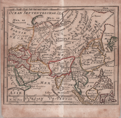
Asie par N. De Fer Nicolas DE FER Code: MS4028 Measures: 160 x 145 mm Year: 1689 ca. Printed: Paris Price €200.00 Quick view View Details
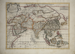
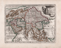
L'Asia Dedicata All' Eccmo. Sigr. Principe d'Auellino. Corretta et... Paolo PETRINI Code: MS6049 Measures: 550 x 405 mm Year: 1700 Printed: Naples Price €1,000.00 Quick view View Details
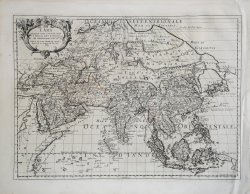
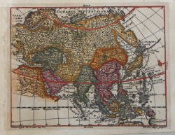
Asiae in Tabula Geographica Delineatio… Adam Friedrich ZURNER Code: S39534 Measures: 590 x 515 mm Year: 1700 ca. Printed: Amsterdam Price €750.00 Quick view View Details
Totius Asiae Henrick SCHERER Code: s34954 Measures: 340 x 240 mm Year: 1702 ca. Printed: Munich Price €350.00 Quick view View Details
Asia Giovanni Antonio MAGINI Code: S42896 Measures: 180 x 140 mm Year: 1713 Printed: Padua Price €180.00 Quick view View Details
L'Asie Dressée selon les Observations de Mrs. de l'Academie Royale... Jacques CHIQUET Code: S40121 Measures: 225 x 170 mm Year: 1719 Printed: Paris Price €180.00 Quick view View Details
Asia Antiqua et Nova Philipp CLUVER Code: S48067 Measures: 265 x 220 mm Year: 1729 Printed: Amsterdam Price €225.00 Quick view View Details
L'Asie Avec le Nouvelles découvertes Georg Louis le ROUGE Code: MS4142.4 Measures: 285 x 230 mm Year: 1756 Printed: Paris Price €180.00 Quick view View Details
Asia Tobias LOBECK & Tobias Conrad LOTTER Code: S4422 Measures: 130 x 100 mm Year: 1762 ca. Printed: Ausburg Price €175.00 Quick view View Details
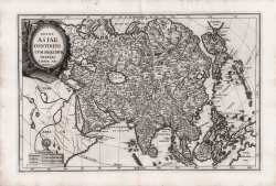
Nou.le Asie ou touts les Points principaux font placessur sur les... Louis Charles DESNOS Code: S35284 Measures: 1200 x 940 mm Year: 1772 Printed: Paris Price €3,500.00 Quick view View Details