
- New
| Reference: | A54501 |
| Author | Giovanni Antonio MAGINI |
| Year: | 1596 |
| Zone: | Carta Marina |
| Printed: | Venice |
| Measures: | 180 x 140 mm |
| Reference: | A54501 |
| Author | Giovanni Antonio MAGINI |
| Year: | 1596 |
| Zone: | Carta Marina |
| Printed: | Venice |
| Measures: | 180 x 140 mm |
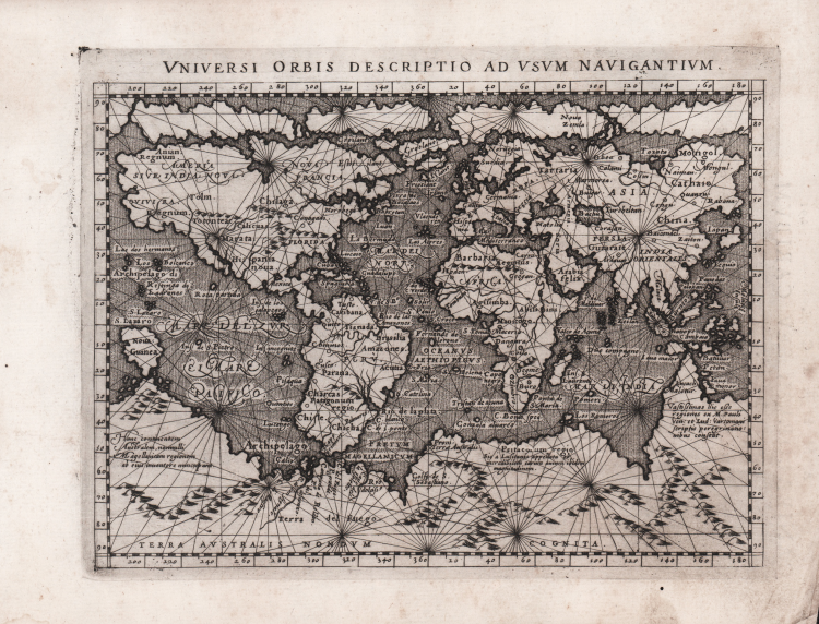
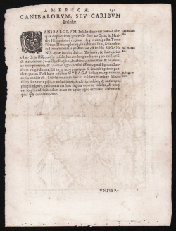
A rare first edition from 1596, with Latin text on the verso.
This nautical world map is a reduced version of Gerard Mercator’s large 1569 wall map, created by Giovanni Magini for his edition of Ptolemy’s *Geographia* (1596). It is among the first maps, other than those by Mercator himself, to employ his famous cylindrical projection.
Incorporating a feature from its illustrious source, Magini’s small map is elegantly embellished with rhumb lines (or loxodromes). While not practical for navigation on a map of such small scale, they convey the concept of "navigability" to the viewer, reflecting a world in which circumnavigation had become a reality.
Magini’s depiction of the American continent, largely unexplored by Europeans at the time, is highly speculative. The east coast bulges eastward, a result of inaccurate measurements of longitude and magnetic declination. No rivers appear along the Gulf coast. The St. Lawrence River is recognizable, while a river flowing into the Gulf of California roughly corresponds to the Colorado. Mexico City is marked. The mythical kingdom of Norumbega is indicated along the Atlantic coast. The Pacific Northwest is depicted almost entirely conjecturally, featuring the apocryphal kingdoms of Anian (derived from Marco Polo), Quivira (a golden kingdom associated with Coronado’s expedition), and Tolm (also derived from Marco Polo).
Although the map predates the official discovery of Australia in 1606, a large promontory extending northward from *Terra Australis* bears a striking resemblance to the western coast of the southern continent. The lands of Maletur and Lucach, also mentioned by Marco Polo, are marked along the coast.
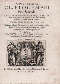
Magini’s *Geographiae universae tum veteris tum novae absolutissimum opus voluminibus distinctum*, featuring 63 finely engraved copperplates by Girolamo Porro, was printed in Venice in 1596 with a Latin text. The work combines classical texts on ancient geography with an extensive set of engraved maps updated to reflect 16th-century knowledge. This *Geographia* marks a transitional moment between the Ptolemaic tradition and modern cartography and is considered today one of the most significant geographical works of the Renaissance. In 1597, it was copied by Petrus Keschedt, a publisher from Cologne; while the maps in the two editions appear nearly identical, closer examination reveals numerous differences. It was subsequently reprinted in Venice with an Italian translation by Lorenzo Cernoti under the title *Geografia cioè descrittione universale della Terra* (1598); in this edition, the maps engraved by Porro are integrated directly into the text pages. Finally, a posthumous reprint of the Italian translation was produced in Padua by the Galignani brothers in 1621.
Girolamo Porro (1520–1604) was a Venetian engraver, humanist, illustrator, cartographer, and publisher. Born in Padua, he spent most of his life in Venice. He collaborated with numerous prominent Venetian humanists, including Camillo Camilli, Scipione Barbuo, Porcacchi, Ruscelli, and Ariosto. Although his cartographic output was limited, it included works of great importance, such as the maps for Porcacchi’s *Isole più famose del mondo* (1572).
Etching and engraving; Latin text on the verso; in excellent condition.
Bibliografia
R. Shirley, The Mapping of the World, n. 196; F. Fatichenti, Specificità, fortuna e auctoritas del canone tolemaico, in Bifolco/Ronca “Cartografia e topografia italiana del XVI secolo”, pp. 65-72.
Giovanni Antonio MAGINI (1555 - 1617)
|
Giovanni Antonio Magini was born in Padua in 1555, dedicating himself to the study of astronomy from an early age. In 1588 the Senate of Bologna appointed him Lecturer of Astronomy at the local University, choosing him instead of Galileo Galilei. His friendship with the Duke of Mantua, Vincenzo Gonzaga, helped Magini in his quest to obtain cartographical material for map-making from the various sovereigns ruling the different Italian states at that time. Because of Magini's early death in 1617, this effort was made famous by his son Fabio when he published the atlas "L'Italia" in Bologna in 1620. This is the first example of an Italian atlas and is made up of 24 pages of descriptive text and 61 maps of the Italian peninsula. Although this work was published posthumously, it can be entirely ascribed to Magini. He began drawing this maps around 1594, with the one depicting Bologna and its surrounding territories being the first. They were all printed before 1620 in draft editions which were then revised and updated for the final version. These draft proofs are extremely rare, although sometimes available for sale, and exhibit substantial differences in respect to the maps finally included in the atlas. Two of the most famous engravers of the time, Arnoldo Arnoldi and the englishman Benjamin Wright, were entrusted by Magini to engrave the plates. As we shall see in the presentation of the separate maps, they derive from different sources, both known and unknown, and therefore represent the result of an original work of critical analysis and compilation. This atlas had an important influence on the cartography of the italian peninsula for the following two centuries, beginning from Ortelius and going on to the principal dutch cartographers and editors.
|