Verona Venetie Civitas Werner Rolevinck Code: S22238 Measures: 75 x 60 mm Year: 1474 ca. Printed: Cologne Price €150.00 Quick view View Details
Padua citta de Venetia & Sequita la citta d’Aquilea & della ruina Giacomo Filippo FORESTI Code: S13206 Measures: 140 x 117 mm Year: 1490 ca. Printed: Venice Price €180.00 Quick view View Details
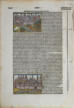
Siena Citta [Padova] Giacomo Filippo FORESTI Code: S1262 Measures: 140 x 90 mm Year: 1490 ca. Printed: Venice Price €225.00 Quick view View Details
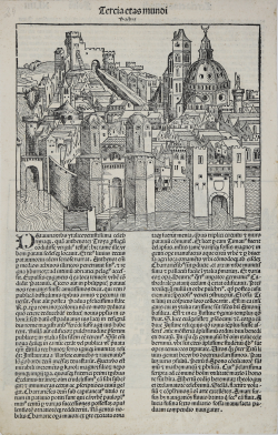
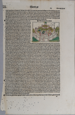
Padua Hartmann SCHEDEL Code: S22045 Measures: 255 x 395 mm Year: 1493 Printed: Nurnberg Price €600.00 Quick view View Details
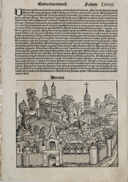
Verona Hartmann SCHEDEL Code: s22241 Measures: 225 x 192 mm Year: 1493 Printed: Nurnberg Price €325.00 Quick view View Details
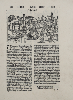
Verona Johann Schönsperger Code: S39479 Measures: 215 x 307 mm Year: 1496 Printed: Augsburg Price €300.00 Quick view View Details
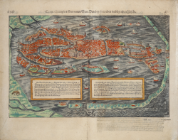
Contrafehtung der Furnemmen Statt Venedig / Sampt den umbligenden... Sebastian Münster Code: S17408 Measures: 400 x 325 mm Year: 1550 ca. Printed: Basle Price €750.00 Quick view View Details
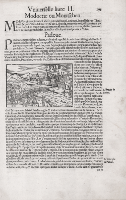
Padoue Sebastian Münster Code: S50050 Measures: 100 x 65 mm Year: 1552 Printed: Basle Price €125.00 Quick view View Details
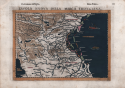
Tavola Nuova della Marca Trivigiana Girolamo RUSCELLI Code: S19365 Measures: 263 x 190 mm Year: 1561 ca. Printed: Venice Price €325.00 Quick view View Details
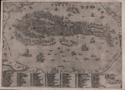
Venetia Paolo FORLANI Code: S41900 Measures: 265 x 192 mm Year: 1567 Price €1,800.00 Quick view View Details
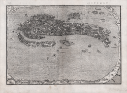
Venezia Leandro ALBERTI Code: S50070 Measures: 248 x 170 mm Year: 1567 Printed: Venice Price €900.00 Quick view View Details
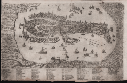
Venetia Ferrando BERTELLI Code: S22264 Measures: 307 x 195 mm Year: 1568 ca. Printed: Venice Price €2,500.00 Quick view View Details
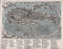
Venetia Donato BERTELLI Code: S40841 Measures: 290 x 225 mm Year: 1569 Price €2,500.00 Quick view View Details
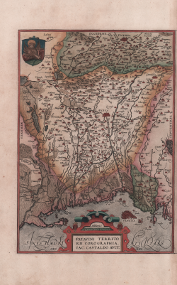
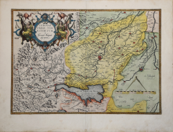
Patavini Territorii Corographia, Iac. Castaldo Auct. Abraham ORTELIUS Code: S1501 Measures: 220 x 310 mm Year: 1570 ca. Printed: Antwerpen Price €325.00 Quick view View Details
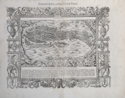
Pourtraict de la magnifique Cité de Venise Francois de BELLEFOREST Code: S47351 Measures: 435 x 340 mm Year: 1575 Printed: Paris Price €1,100.00 Quick view View Details
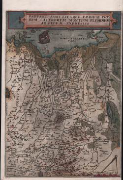
Paduani agri eiusque urbium vicorum castrorum montium fluminum ad.. Gerard DE JODE Code: S11209 Measures: 260 x 372 mm Year: 1578 ca. Printed: Antwerpen Price €900.00 Quick view View Details
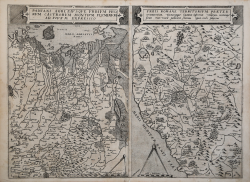
Paduani Agri Eiusque Urbium Vicorum Catrorum... / Urbis Romane... Gerard DE JODE Code: CO-124 Measures: 510 x 380 mm Year: 1578 Printed: Antwerpen Price €1,750.00 Quick view View Details
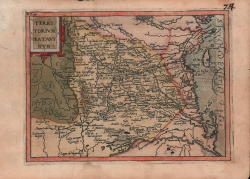
Territorium Patavinum Jan MATAL [METELLUS] Code: s25017 Measures: 200 x 155 mm Year: 1579 ca. Printed: Cologne Price €1,000.00 Quick view View Details
Veronae Vrbis Territorivm Abraham ORTELIUS Code: s24103 Measures: 470 x 330 mm Year: 1579 ca. Printed: Antwerpen Price €700.00 Quick view View Details
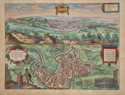
Magnifica Illa Civitas Verona - Colonia Augusta Verona Nova... Georg BRAUN & Franz HOGENBERG Code: S49238.54 Measures: 475 x 365 mm Year: 1581 ca. Printed: Antwerpen & Cologne Price €700.00 Quick view View Details
![Siena Citta [Padova]](https://www.antiquarius.it/25025-home_default/siena-padova.jpg)