| Reference: | s5005 |
| Author | Johannes BLAEU |
| Year: | 1635 |
| Zone: | Leòn & Asturie |
| Printed: | Amsterdam |
| Measures: | 503 x 385 mm |
| Reference: | s5005 |
| Author | Johannes BLAEU |
| Year: | 1635 |
| Zone: | Leòn & Asturie |
| Printed: | Amsterdam |
| Measures: | 503 x 385 mm |
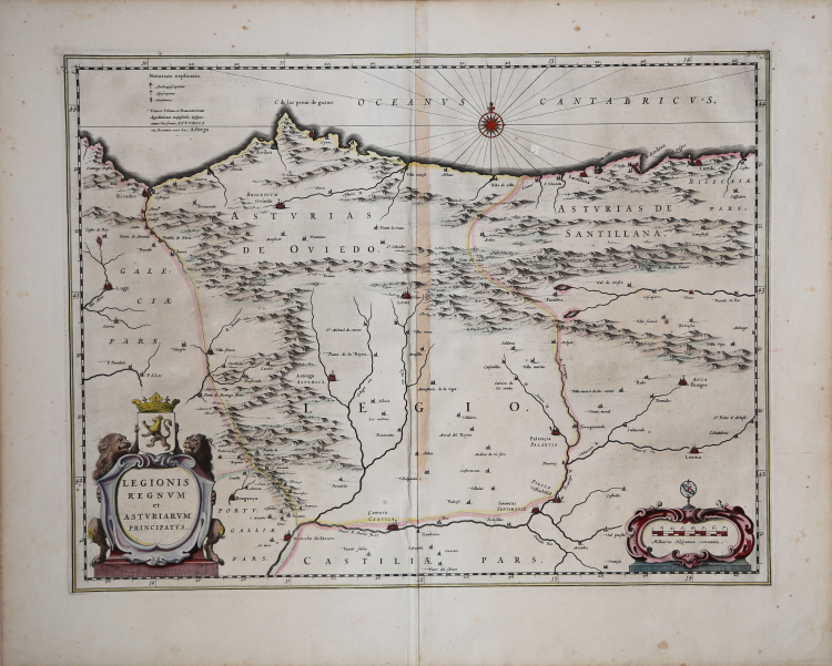
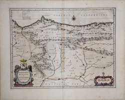
Map of Asturias and Leon, from the Atlas Major by Johannes Blaeu. German text to the verso
Some detail of the neighbouring regions of Gallicia showing Lugo and Asturias de Santillana showing Santillana del Mar and Laredo is also shown.
Willem Janszoon Blaeu, started in 1599 his business as a builder of globes and astronomical instruments in Amsterdam. In 1630, after buying some plates of the Mercator atlas from Jodocus Hondius II, he was able to publish a volume of 60 maps under the title Atlantis Appendix. Five years later, he published the first two volumes of his atlas Atlas Novus or Theatrum Orbis Terrarum, in six books. After his death, Joan (Johannes) continued his father's work, completing the entire six-volume Atlas Novus series around 1655. He was also the author of an Atlas Maior sive Cosmographia Blaviana, in 12 volumes published in 1662 -72.
Etching on copperplate with original hand colour, in good conditions.
Johannes BLAEU (Alkmaar 1596 circa - Amsterdam 1663)
|
Joan Blaeu was the eldest son of Willem Janszoon Blaeu (1571-1638), and was probably born in Alkmaar in the province of Noord-Holland in the final years of the 16th century. He was brought up in Amsterdam, and studied law at the University of Leiden before going into partnership with his father in the 1630s. He became chief cartographer to the Dutch East India Company from 1638, and from 1651 to 1672 he served on the Amsterdam City Council without a break, holding several public offices. He also invested in Dutch colonial interests in North America. Joan Blaeu main work was Theatrum Orbis Terrarum (or Atlas Maior as it had became known.) Atlas had expanded to between 9 and 12 volumes, depending on the language. With over 3,000 text pages and approximately 600 maps, it was the most expensive book money could buy in the later 17th century. In 1638 Willem Blaeu died and the business passed into the hands of his sons, Joan and Cornelis, who continued and expanded their father's ambitious plans. After the death of Cornelis, Joan directed the work alone and the whole series of 6 volumes was eventually completed about 1655. As soon as it was finished he began the preparation of the even larger work, the Atlas Major, which reached publication in 1662 in II volumes (later editions in 9-12 volumes) and contained nearly 6oo double-page maps and 3,000 pages of text. This was, and indeed remains, the most magnificent work of its kind ever produced; perhaps its geographical content was not as up-to-date or as accurate as its author could have wished, but any deficiencies in that direction were more than compensated for by the fine engraving and colouring, the elaborate cartouches and pictorial and heraldic detail and especially the splendid calligraphy. In 1672 a disastrous fire destroyed Blaeu's printing house in the Gravenstraat and a year afterwards Joan Blaeu died. The firm's surviving stocks of plates and maps were gradually dispersed, some of the plates being bought by F. de Wit and Schenk and Valck, before final closure in about 1695.
|