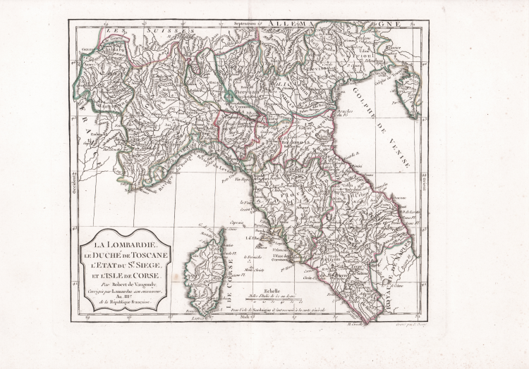
| Reference: | CO-334 |
| Author | Gilles Robert de VAUGONDY |
| Year: | 1750 ca. |
| Zone: | North of Italy |
| Measures: | 310 x 265 mm |
| Reference: | CO-334 |
| Author | Gilles Robert de VAUGONDY |
| Year: | 1750 ca. |
| Zone: | North of Italy |
| Measures: | 310 x 265 mm |
Gilles Robert de VAUGONDY (1688 - 1766)
|
Didier Robert de Vaugondy (1723-1786) was appointed Geographer to Louis XV in 1760. At the same time, de Vaugondy served as Geographer to the Duke of Lorraine and Bar, father-in-law to Louis XV and former King of Poland.
His major contributions to French cartography are the Atlas Universel, 1750-57, The Nouvelle Atlas Portatif (1784) and a very popular map of North America published in 1761. He was son of Gilles Robert de Vaugondy who succeeded Pierre Sanson as the King's Geographer.
|