
| Reference: | CO-573 |
| Author | Victor LEVASSEUR |
| Year: | 1838 |
| Zone: | North of Italy |
| Printed: | Paris |
| Measures: | 125 x 85 mm |
| Reference: | CO-573 |
| Author | Victor LEVASSEUR |
| Year: | 1838 |
| Zone: | North of Italy |
| Printed: | Paris |
| Measures: | 125 x 85 mm |
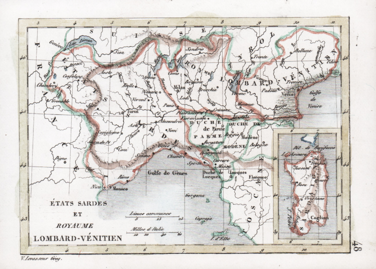
Piccola carta geografica tratta dall’Atlas classique universel de Géographie ancienne et moderne stampato da Didier, Parigi, 1838.
Alante tascabile con 87 mappe, alcune delle quali su fogli ripiegati. Il volume comprende 2 carte celesti, 2 geologiche, il mappamondo, 23 carte storiche, 23 carte d'Europa, 9 d'Asia, 5 d'Oceania, 8 d'Africa, 11 delle Americhe e 1 carta dei luoghi Europei legati a importanti avvenimenti storici.
Victor Levasseur, nato l'8 dicembre 1800 a Caen e morto il 4 febbraio 1870 a Parigi, è stato un ingegnere geografo e geometra impiegato presso il Dipartimento di Ingegneria del Catasto e della Città di Parigi a metà del XIX secolo.
Litografia, coloritura antica, buono stato di conservazione.
|
Victor Levasseur, born Dec. 8, 1800, in Caen and died Feb. 4, 1870, in Paris, was an engineer-geographer and surveyor employed by the Engineering Department of the Cadastre and City of Paris in the mid-19th century. The son of Brigadier General Victor Levasseur, he is best known for his large Atlas (National) Illustré des 86 (89 après 1859) Départements et des Possessions de La France showing French departments and French colonies in America, Africa and Asia. His cartographic works and statistics are appreciated today more for the characteristic decorations surrounding the maps than for the details of the maps themselves. The hand-colored boundary maps (up to 1859) are a treasured memento of the 19th century, surrounded by engravings with statistics, historical notes, and characteristic illustrations of the departments and colonies. The maps show roads, railroads, and waterways; the departments are divided into arrondissements, cantons, and communes; the work is based on the Dépôt de la Guerre and Ponts et Chaussées Cadastre and was widely used in town halls.
|
|
Victor Levasseur, born Dec. 8, 1800, in Caen and died Feb. 4, 1870, in Paris, was an engineer-geographer and surveyor employed by the Engineering Department of the Cadastre and City of Paris in the mid-19th century. The son of Brigadier General Victor Levasseur, he is best known for his large Atlas (National) Illustré des 86 (89 après 1859) Départements et des Possessions de La France showing French departments and French colonies in America, Africa and Asia. His cartographic works and statistics are appreciated today more for the characteristic decorations surrounding the maps than for the details of the maps themselves. The hand-colored boundary maps (up to 1859) are a treasured memento of the 19th century, surrounded by engravings with statistics, historical notes, and characteristic illustrations of the departments and colonies. The maps show roads, railroads, and waterways; the departments are divided into arrondissements, cantons, and communes; the work is based on the Dépôt de la Guerre and Ponts et Chaussées Cadastre and was widely used in town halls.
|