
| Reference: | s20614 |
| Author | Jan Barend ELWE |
| Year: | 1792 |
| Zone: | Scandinavia |
| Printed: | Amsterdam |
| Measures: | 600 x 450 mm |
| Reference: | s20614 |
| Author | Jan Barend ELWE |
| Year: | 1792 |
| Zone: | Scandinavia |
| Printed: | Amsterdam |
| Measures: | 600 x 450 mm |
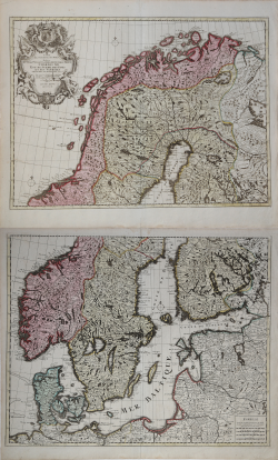
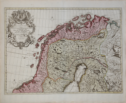
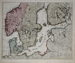
Large map of the northern part of Scandinavia on 2 sheets, covering Norway, Sweden and Finland, to the Baltic and part of Poland.
At the left hand top an elaborate cartouche, stating that the map was originally designed by de l'Isle, and edited by Elwe in 1792.
A fine large map with many details.and in original colouring.
KOEMAN , part II , EL2. map 16.
Jan Barend ELWE (Attivo tra 1785 - 1809)
|
A bookseller and publisher who reproduced a small number of maps copied from his predecessors.
|
Jan Barend ELWE (Attivo tra 1785 - 1809)
|
A bookseller and publisher who reproduced a small number of maps copied from his predecessors.
|