
| Reference: | S50365 |
| Author | Francesco Costantino MARMOCCHI |
| Year: | 1858 |
| Zone: | Transmississippi West |
| Printed: | Genua |
| Measures: | 305 x 360 mm |
| Reference: | S50365 |
| Author | Francesco Costantino MARMOCCHI |
| Year: | 1858 |
| Zone: | Transmississippi West |
| Printed: | Genua |
| Measures: | 305 x 360 mm |
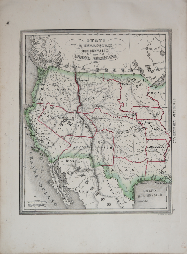
Very rare and fascinating map of the Transmississippi West, from Marmocchi's Il Globo--Atlante di carte geografiche . . . , published in Genoa.
This is a very scarce Italian map illustrating the western part of the United States. The map shows the region with a pre-Gadsden Purchase border with Mexico. It covers the area from the Mississippi River to the west coast. All the states and territories are misshapen. A large Kasas territory covers present-day Oklahoma, Kansas and Nebraska. In the Pacific Northwest, there is a large Oregonia territory that covers Washington, Oregon and Idaho. < I>Yutah envelopes the Gran Iago Salato (Great Salt Lake) and the headwaters of several spurious rivers that flow through the Great Basin to the Pacific. One of the most interesting features of the map is the region labeled Arrissonia below the Gila River. This is one of the earliest notations regarding Arizona.
Etching with contemporary colouring, good condition.
Francesco Costantino MARMOCCHI (Poggibonsi 1805 - Genova 1858)
|
Italian geographer, he was the author of several works on geography: Corso di geografia universale sviluppato in cento lezioni (I-III, Firenze 1840-43), Geografia d’Italia in two volumes; lAbrégé de la géographie de l’île de Corse (Bastia 1852); Corso di geografia commerciale in two volumes; anAtlas in folio including 50 plates (Genova 1854-57); and unfinished works as Dizionario di geografia universale (I-II, Torino 1858-62) and Descrizione geografica, cartografica e storica dell’Impero anglo-indiano, published in installments from1857 (continued by G. Flecchia).
|