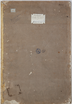
| Reference: | VR59FR |
| Author | Joseph ROUX |
| Year: | 1750 ca. |
| Zone: | Mediterranean Sea |
| Printed: | Marsiglia |
| Measures: | - x - mm |
| Reference: | VR59FR |
| Author | Joseph ROUX |
| Year: | 1750 ca. |
| Zone: | Mediterranean Sea |
| Printed: | Marsiglia |
| Measures: | - x - mm |
Atlas of the Mediterranean Sea of the Marseilles hydrograph Joseph Roux, based on the charts oby Francois Berthelot.
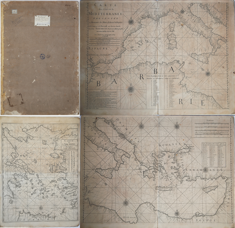
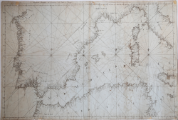
In-folio (405x570 mm), original cardboard with manuscript title, containing 4 double-page charts, depicting the Atlantic coasts of Europe, the general map of the Mediterranean (2 sheets) and the Aegean Sea.
Slightly worn cardboard, defects in the central fold of the first board, charts in good condition.
Nautical Atlas of only four sheets, intended for navigation in the Mediterranean. Include:
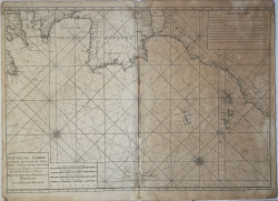
- Nouvelle Carte de Partie des Costes de Terre ferme et isles situées sur l'Ocean […] Dressée par le sieur Berthelot Hydrographe de la ville de Marseille (chart of the Atalntic Coasts of Europe, dim. 790x570 mm).
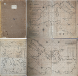
- Carte des Cotes de la Mer Mediterrannee Presentée a Messieurs les Maire, Echevins, et Deputés du Commerce de Marseilles par leur tres humble Serviteur Berthelot Professeur d’Hydrographie entretenu du Roy et de la ville. Chez Joseph Roux hydrographe du Roy A Marseille (2 sheets chart of the Mediterranean sea, size 540x440 mm each one, signed: Chez Joseph Roux hydrographe du Roy A Marseille).
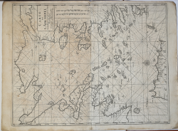
- Carte de L'Archipel. Nouvellement Corrigée pa le Sieur Berthelot Professeur d'Hydrographie entreten du Roy et de la Ville de Marseille (chart of the Aegean Sea, dim. 560x720 mm).
Nautical Atlas published by Joseph Roux, based on the charts by Berthelot of 1693. It is an almost identical copy, slightly reduced in size.
The lists of islands are also identical; in the western sheet, in a box, the Noms de quelques Ports et Isles Situées entre le Meridien de Gibaltar and celuy de Cephalonie are listed, a list of 49 islands in the western Mediterranean. In the eastern sheet, in a box, we find the Nomes de quelques Isles Situees entre le Meridien de Cephalonie and Celuy d'Alexandrette, a list of 45 islands - mainly of the Aegean Sea - between the two meridians.
Roux credits Berthelot as the author of the chart; in the western sheet, in a box in the lower left corner: Avis. La Carte de la Méditerranée de Feu No. Berthelot a été recue avec a générale appobation du Public: mais le Graveur qui là éxécutée a si mal réussi que depuis long tems on desire that quelre autre entreprenne de recommencer cet ouvrage [...]. Thus, Joseph Roux, with the motivation that the Berthelot card was clumsily engraved, makes this copy of the Mediterranean nautical table.
The Rouxs of Marseille were a family of hydrographers and painters specializing in portraits of seamen and ships. Joseph Roux was born in 1725, by Joseph Roux, who worked as a hydrographer, and Magdaleine Senequier. He immediately devoted himself to the family business, becoming a hydrograph like his father, producing, publishing and selling a vast assortment of nautical charts, navigation instruments. Around the middle of the century, he received the honor of Hidrographe du Roy and, in 1764, published a series of 12 Mediterranean charts, a nautical atlas that was used for a number of years, even used on English ships. At the same time, he published a small atlas of 65 plates, of pocket size, with the nautical plans of the main Mediterranean ports. The "Recueil des principaux plans des ports & rades de la Méditerranée" was published for the first time in Marseille in 1764 and subsequently reprinted - expanded - in Genoa by Yves Gravier with the title "Recueil de 163 principaux plans des ports et rades de la Mediterranée" (1804 ).
Throughout the nineteenth century, several editions followed, some expanded, both in France and in Italy. Some by Roux himself, while others were unauthorized copies.
Devoid of date, this Atlas appears to be an early work by Roux, and certainly precedes its nautical Atlas of the Mediterranean, in 12 sheets, from 1764.
A very good example of this rare Atlas.
Bibliografia: cfr. P. C. F. Smith, The Artful Roux: Marine Painters of Marseille, Peabody Museum of Salem, 1978; cfr. R. Shirley, Maps in the Atlases of the British Library, Londra, 2004, p. 1276.
|
S. Bifolco, "Mare Nostrum, Cartografia nautica a stampa del Mar Mediterraneo" (2020), pp. 270-271, tav. 126.
|
Joseph ROUX (Attivo nella seconda metà del XVIII sec.)
|
Joseph Roux was a Marseilles hydrographer who both published and as well manufactured and sold charts, navigating instruments and related nautical equipment.
At about the mid-century, he received the right to be called "Hidrographe du Roy," and in 1764 published a series of 12 charts of the Mediterranean; he simultaneously published this smaller format atlas of 65 harbor charts. Several editions followed until well into the 19th century, both in France and in Italy, all enlarged. Some were by Roux himself, some were pirated.
Sanderson, The Sea Chart, p. 91, calls this "a popular book," but few examples survive, and all editions are rare
|
|
S. Bifolco, "Mare Nostrum, Cartografia nautica a stampa del Mar Mediterraneo" (2020), pp. 270-271, tav. 126.
|
Joseph ROUX (Attivo nella seconda metà del XVIII sec.)
|
Joseph Roux was a Marseilles hydrographer who both published and as well manufactured and sold charts, navigating instruments and related nautical equipment.
At about the mid-century, he received the right to be called "Hidrographe du Roy," and in 1764 published a series of 12 charts of the Mediterranean; he simultaneously published this smaller format atlas of 65 harbor charts. Several editions followed until well into the 19th century, both in France and in Italy, all enlarged. Some were by Roux himself, some were pirated.
Sanderson, The Sea Chart, p. 91, calls this "a popular book," but few examples survive, and all editions are rare
|