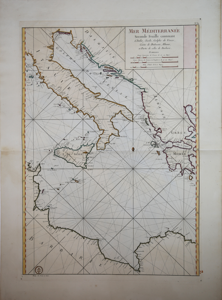
| Reference: | MS6648 |
| Author | Jacques Nicolas BELLIN |
| Year: | 1770 ca. |
| Zone: | Italy |
| Printed: | Paris |
| Measures: | 545 x 780 mm |
| Reference: | MS6648 |
| Author | Jacques Nicolas BELLIN |
| Year: | 1770 ca. |
| Zone: | Italy |
| Printed: | Paris |
| Measures: | 545 x 780 mm |
To fight against the powerful English fleet, king Louis XIV decided to endow his ships with nautical charts that could enable them to compete with the enemy. The Neptune Francais, in 1693, can be considered a first attempt, but it was only at the beginning of the Eighteenth century that a campaign of study of the Mediterranean coasts and sea was started, leading to the realization of maps, collected in the Dépot des Cartes et Planes de la Marine in 1720. Nevertheless, the real founder of French hydrography can be considered Jacques Nicolas Bellin (1703-1772), who served for more than fifty years the navy as engineer and cartographer, which win him first the title of "Hydrographer Engineer of the Navy" and then of "Royal Hydrographer". His first commitment was to study the French coasts fisrt, and then of the whole world. His production was massive and his nautical charts, due also to their quality, were published in many edition until the end of the XVIII century. This allowance led to the production and the selling of sea charts, at first based on those from Bellin, then developed by other navy engineers. The sea charts were sold separately, all bearing the stamp with the anchor and the crowns of the Depot Generale de la Marine. Collections of the same charts have been published under the name of Neptune Francois, a monumental work which has been reissued many times until the half of the following century. The following group of charts is taken from a volume entitled Neptune de la Méditerranée, about the Mediterranean sea. Where possible, there is the name of the cartographer, very often the captain of the ship, and the date of the chart. Engravings, in excellent condition.
Jacques Nicolas BELLIN (1703 - 1772)
|
Jacques-Nicolas Bellin (1703 - 1772) was one of the most important cartographers of the 18th century.
With a career spanning some 50 years, Bellin is best understood as transitional mapmaker spanning the gap
between 18th and early 19th century cartographic styles. His long career as Hydrographer and Ingénieur
Hydrographe at the French Dépôt des cartes et plans de la Marine resulted in hundreds of high quality
nautical charts of practically everywhere in the world. Bellin's work focuses on function and accuracy
tending in the process to be less decorative than the earlier 17th and 18th century cartographic work. In
addition to numerous maps and charts published during his lifetime, many of Bellin's maps were updated
(or not) and published posthumously. He was succeeded as Ingénieur Hydrographe by his student, also a prolific and influential cartographer, Rigobert Bonne.
|