| Reference: | S40347 |
| Author | MOGALLI Niccolò- PETROSCHI Giovanni |
| Year: | 1763 |
| Zone: | Rome |
| Printed: | Rome |
| Measures: | 540 x 395 mm |
| Reference: | S40347 |
| Author | MOGALLI Niccolò- PETROSCHI Giovanni |
| Year: | 1763 |
| Zone: | Rome |
| Printed: | Rome |
| Measures: | 540 x 395 mm |
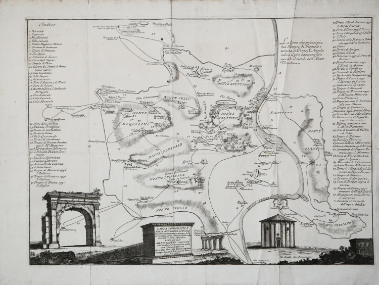
Topographical map of the vestiges of ancient Rome, with vertical projection and figuration, published in 1763 in Ridolfino Venuti's work "Accurata, e succinta descrizione topografica delle antichità di Roma".
Engraved by Niccolò Mogalli and Giovanni Petroschi, based on a drawing by R. Venuti.
The toponymic indications are partly given in the plan, partly in a 77-number rubric placed at the sides. At lower right is the signature of the engravers.
First edition with the date MDCCLXIII; the second edition of the plate, bears the date 1823.
Copperplate engraving, usual paper creases, otherwise in good condition.
|
Frutaz, Le piante di Roma, XXXVIII; L. Schudt, Le guide di Roma, p. 405, n. 769; Caldana (2013): p. 107, n. I.64.
|
MOGALLI Niccolò- PETROSCHI Giovanni
|
Frutaz, Le piante di Roma, XXXVIII; L. Schudt, Le guide di Roma, p. 405, n. 769; Caldana (2013): p. 107, n. I.64.
|
MOGALLI Niccolò- PETROSCHI Giovanni