| Reference: | S1457 |
| Author | Didier Robert de VAUGONDY |
| Year: | 1748 |
| Zone: | Genova |
| Printed: | Paris |
| Measures: | 181 x 165 mm |
| Reference: | S1457 |
| Author | Didier Robert de VAUGONDY |
| Year: | 1748 |
| Zone: | Genova |
| Printed: | Paris |
| Measures: | 181 x 165 mm |
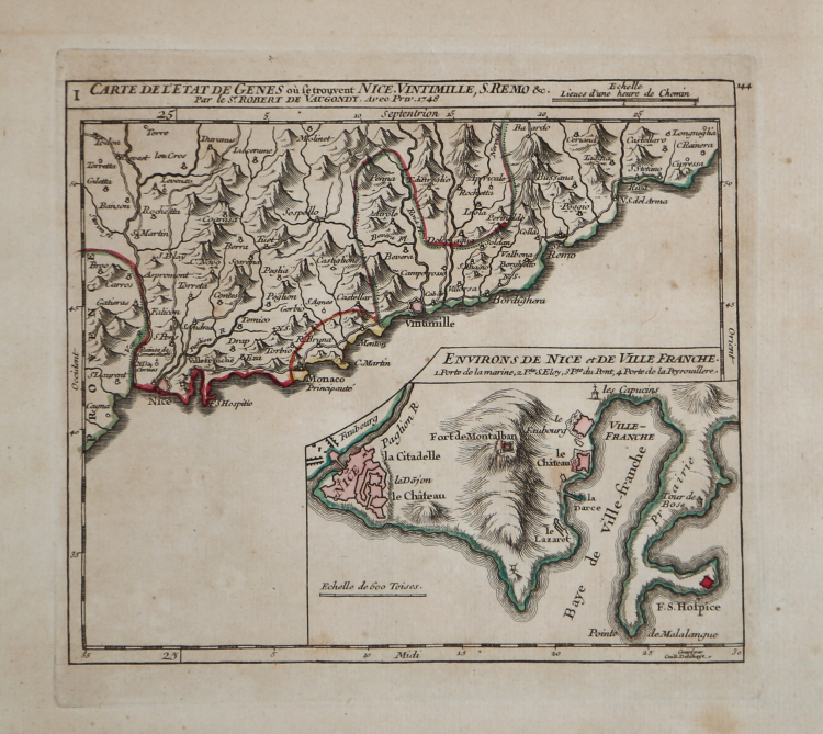
Carta geografica della liguria tratta da "Gilles Robert de Vaugondy, Atlas portatif universel et militaire", Paris, Durand & Pissot, 1748-1749.
Incisione in rame, coloritura coeva dei contorni, in buono stato di conservazione.
Didier Robert de VAUGONDY (1723 ca. - 1786)
|
Didier Robert de Vaugondy (1723-1786) was appointed Geographer to Louis XV in 1760. At the same time, de Vaugondy served as Geographer to the Duke of Lorraine and Bar, father-in-law to Louis XV and former King of Poland.
His major contributions to French cartography are the Atlas Universel, 1750-57, The Nouvelle Atlas Portatif (1784) and a very popular map of North America published in 1761. He was son of Gilles Robert de Vaugondy who succeeded Pierre Sanson as the King's Geographer.
|