| Reference: | S38603 |
| Author | William Albert BACHIENE |
| Year: | 1750 |
| Zone: | The Holy Land |
| Printed: | Gorinchem |
| Measures: | 515 x 405 mm |
| Reference: | S38603 |
| Author | William Albert BACHIENE |
| Year: | 1750 |
| Zone: | The Holy Land |
| Printed: | Gorinchem |
| Measures: | 515 x 405 mm |
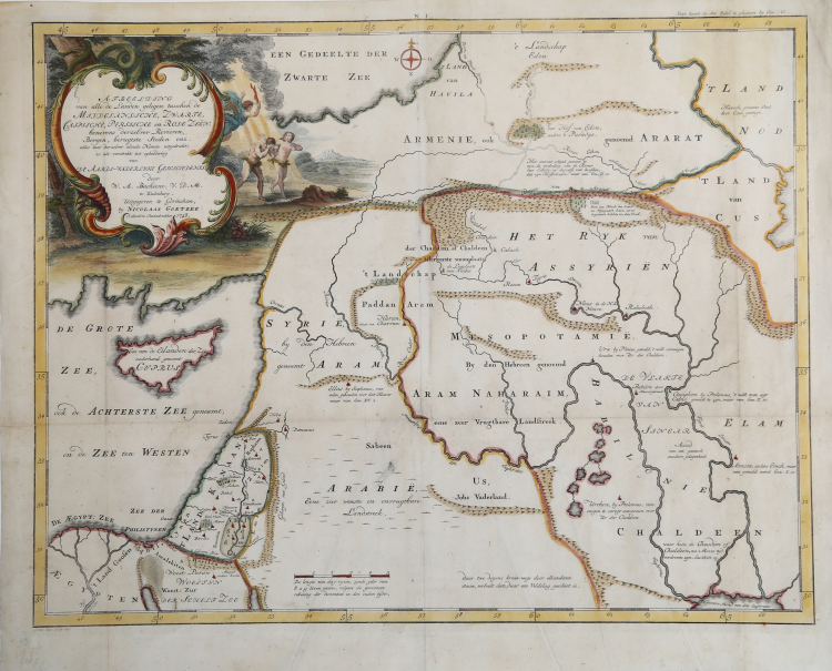
This attractive map from a large Dutch Bible shows the land of Israel with all the places, rivers, mountains, and seas mentioned in the Holy Scriptures.
Copperplate with fine later hand colour, very good condition.
Engraved by Jan van Jagen and published in a Dutch Bible by Nicolas Goetzee.
William Albert BACHIENE Leerdaam 1712 - Maastricht 1783
|
Professor of mathematics and astronomer at Maastricht, he was the author of several atlases including the most important is the "Atlas der tot opheldering hedendaagsche Histoire" of 1785, whose maps are engraved by Jan van Jagen. References: Koeman vol. I pp.53-55; Tooley p.65.
|