
| Reference: | s34928 |
| Author | François HALMA |
| Year: | 1704 |
| Zone: | The Holy Land |
| Printed: | Amsterdam |
| Measures: | 505 x 394 mm |
| Reference: | s34928 |
| Author | François HALMA |
| Year: | 1704 |
| Zone: | The Holy Land |
| Printed: | Amsterdam |
| Measures: | 505 x 394 mm |
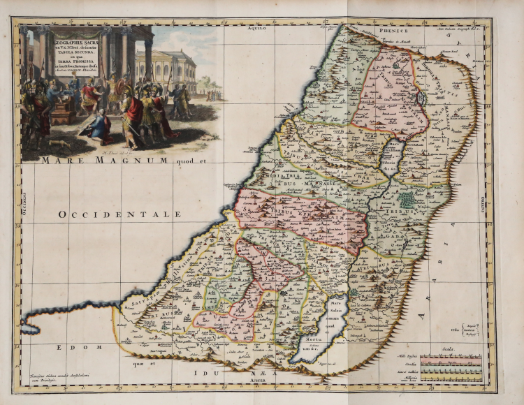
Decorative map of the Holy Land, depicting the Promised Land (or Judea) detailedly divided according to the historical borders of the twelve tribes of Israel.
From the N. Sanson' Geographia sacra: ex veteri et novo testamento desumpta, et in tabulas quatuor concinnata… by Francois Halma.
The Geographia sacra: ex veteri et novo testamento desumpta, et in tabulas quatuor concinnata is a famous work of biblical geography published in Amsterdam in 1704 by the publisher and printer François Halma. The text collects the original cartographic studies of Nicolas Sanson (1600–1667), the celebrated geographer of the King of France, Louis XIV, enriched in this edition by notes by theologian and literary critic Jean Le Clerc (Johannes Clericus).
Copper engraving with fine later hand colour, in good condition.
|
François Halma [Franz Halm, Franciscus Halma (1653 - 1722)] was a Dutch publisher active in Utrecht (starting 1674) and later in Amsterdam where he worked as printer and publisher from 1699-1710. He eventually settled at Leeuwarden, where he died. His output was composed of botanical, theological and historical works, but also, he published a small number of geographies and atlases. In 1695, he published an edition of Gerard Mercator's Ptolemy. His re-issue of Schotanus à Sterringa’s Friesche Atlas in 1698 was regarded among his finest work. He also published an edition of Sanson’s Description de l’Univers. He produced an edition of Falda's plan of Rome in or around 1700. He also caused to be engraved a set of large-format maps of the continents and the world (this latter after Cassini) which are quite rare and appear to have been separately issued. We are aware of institutional copies of the continents having been bound into a 1710 Visscher atlas. The execution of these large and rare maps, drawn by Jan Goeree and engraved by Jan Baptiste, was of a very high quality. The plates were later acquired and reprinted, virtually unchanged, by Pieter van der Aa in 1713.
|
|
François Halma [Franz Halm, Franciscus Halma (1653 - 1722)] was a Dutch publisher active in Utrecht (starting 1674) and later in Amsterdam where he worked as printer and publisher from 1699-1710. He eventually settled at Leeuwarden, where he died. His output was composed of botanical, theological and historical works, but also, he published a small number of geographies and atlases. In 1695, he published an edition of Gerard Mercator's Ptolemy. His re-issue of Schotanus à Sterringa’s Friesche Atlas in 1698 was regarded among his finest work. He also published an edition of Sanson’s Description de l’Univers. He produced an edition of Falda's plan of Rome in or around 1700. He also caused to be engraved a set of large-format maps of the continents and the world (this latter after Cassini) which are quite rare and appear to have been separately issued. We are aware of institutional copies of the continents having been bound into a 1710 Visscher atlas. The execution of these large and rare maps, drawn by Jan Goeree and engraved by Jan Baptiste, was of a very high quality. The plates were later acquired and reprinted, virtually unchanged, by Pieter van der Aa in 1713.
|