
- New
| Reference: | A54592 |
| Author | Gabriel BODENEHR |
| Year: | 1700 ca. |
| Zone: | Florence |
| Printed: | Augsburg |
| Measures: | 275 x 180 mm |
| Reference: | A54592 |
| Author | Gabriel BODENEHR |
| Year: | 1700 ca. |
| Zone: | Florence |
| Printed: | Augsburg |
| Measures: | 275 x 180 mm |
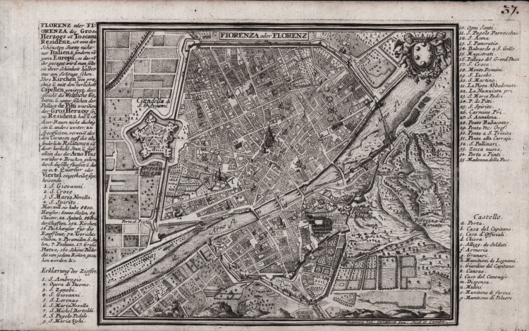
A detailed topographical plan of the city of Florence. The work was created by the German engraver and cartographer Gabriel Bodenehr (1664–1758) and published in Augsburg around 1724–1725. It depicts the urban layout enclosed by the ancient medieval and Renaissance walls. On the left side, the imposing star-shaped structure of the Citadel of San Giovanni (the Fortezza da Basso) is clearly visible. The side margins feature a brief history and an extensive numbered key with 35 references to the city's major monuments, bridges, and landmarks (such as the Duomo, Palazzo Vecchio, and the historic bridges over the Arno)—with no fewer than 15 of these relating to the Fortezza di San Giovanni Battista.
Taken from "Atlas Curieux oder Neuer und Compendieuser Atlas..."—the major work of Gabriel Bodenehr, a German cartographer from a famous family of engravers and publishers in Augsburg. The atlas includes 101 engraved maps, featuring four double-hemisphere world maps, a hydrographic map, maps of the continents, the first four maps relating to the Americas, and detailed maps of Europe and European countries. Some maps bear titles exclusively in Latin.
Etching; minor oxidation spots, otherwise in excellent condition.
|
Gabriel Bodenher was a famous engraver and publisher.In 1716 purchased the plates from Stridbeck and then republished many of his works. In 1704 he published "Atlas Curieux oder Compendieuser und Neuer Atlas".
|
|
Gabriel Bodenher was a famous engraver and publisher.In 1716 purchased the plates from Stridbeck and then republished many of his works. In 1704 he published "Atlas Curieux oder Compendieuser und Neuer Atlas".
|