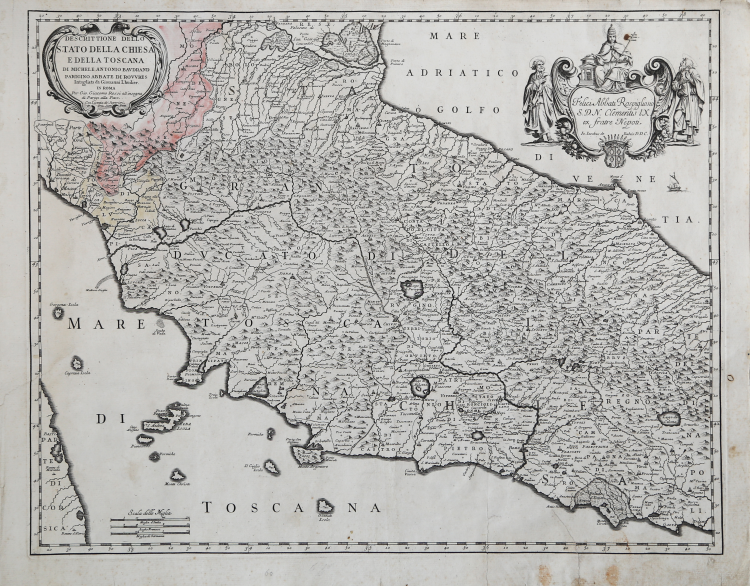
| Reference: | S43972 |
| Author | Michele Antonio BAUDRAND |
| Year: | 1669 ca. |
| Zone: | Central Italy |
| Printed: | Rome |
| Measures: | 560 x 435 mm |
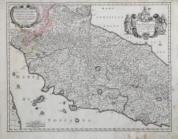
| Reference: | S43972 |
| Author | Michele Antonio BAUDRAND |
| Year: | 1669 ca. |
| Zone: | Central Italy |
| Printed: | Rome |
| Measures: | 560 x 435 mm |
Map taken from Mercurio geografico overo Guida Geografica in tutte le parti del Mondo conforme le Tavole Geografiche del Sansone Baudran de Cantelli Data in luce con direttione, e cura di Gio. Giacomo de Rossi nella sua stamperia collection of maps published in Rome between 1660 and 1730 by the typography De Rossi - the date of the maps goes from 1669 to 1715 - whose first edition is due to Giovanni Giacomo de Rossi. Over the years the atlas was enriched by an increasing number of maps in subsequent editions edited first by Domenico de Rossi and then by his son Filippo.
The Mercurio Geografico is a collection that brings together works by cartographers such as Michele Antonio Baudrand, Nicolas Sanson, Augustin Lubin, Filippo Titi, Giacomo Ameti, Giovanni Antonio Magini and Innocenzo Mattei, and which includes as its main "corpus" the great production of the geographer Giacomo Cantelli da Vignola. The maps are finely copied and engraved by the major engravers of the time including Falda, Widman, Barbey, Widman, Lhuillier, Donia, Mariotti.
Copperplate, with original colouring, some foxing, otherwise very good condition.
Literature
cfr. R. Almagià, Studi storici di cartografia napoletana, in “Archivio storico per le province napoletane”, 38 (1913), p. 645; A. Bonazzi, Il Mercurio geografico: il gioco e la differenza, in “Giacomo Cantelli: geografo del Serenissimo”, Bologna, 1995, p. 37-44 e 150-152; Bagrow 268; Phillips I 254-255; Shirley BL I, pp. 868-874.
Michele Antonio BAUDRAND (Parigi 1633 - 1700)
|
Baudrand, Michel Antonio (1633-1700), geographer to the King of France, prepared a fine world map published by G. G. Rossi at Rome in 1658. Part of New Zealand's west coast is shown but it is erroneously noted as discovered in 1644
|
Michele Antonio BAUDRAND (Parigi 1633 - 1700)
|
Baudrand, Michel Antonio (1633-1700), geographer to the King of France, prepared a fine world map published by G. G. Rossi at Rome in 1658. Part of New Zealand's west coast is shown but it is erroneously noted as discovered in 1644
|