| Reference: | s24751 |
| Author | Giovanni Antonio RIZZI ZANNONI |
| Year: | 1785 ca. |
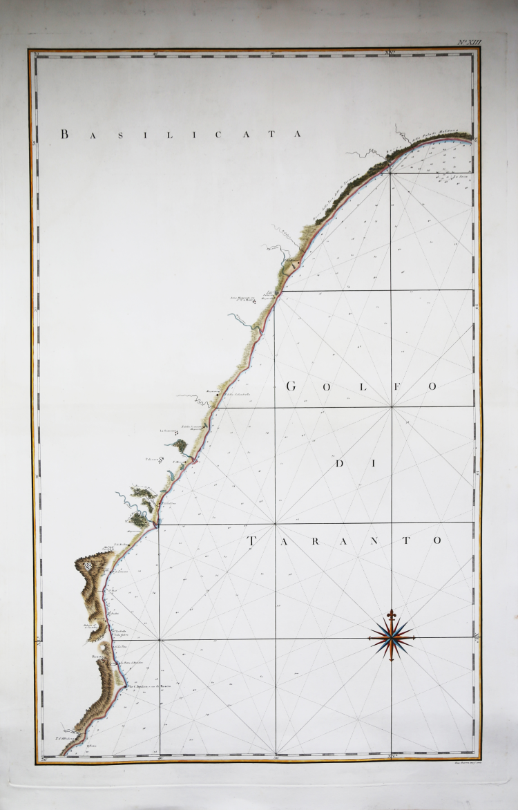
| Zone: | Golfo di Taranto |
| Printed: | Naples |
| Measures: | 630 x 940 mm |
| Reference: | s24751 |
| Author | Giovanni Antonio RIZZI ZANNONI |
| Year: | 1785 ca. |
| Zone: | Golfo di Taranto |
| Printed: | Naples |
| Measures: | 630 x 940 mm |
Nautical chart taken from the famous Atlante Marittimo delle Due Sicilie (Maritime Atlas of the Two Sicilies) by Rizzi Zannoni, printed between 1783 and 1792.
Engraved by Giuseppe Guerra.
Rizzi Zannoni is considered as the most important Italian cartographer since Giovanni Antonio Magini. Active in France, Padua and especially in Naples (1781/1814), where, in the Bourbon period, he could also boast the title of "geographer of the King". With the coming of the French, Rizzi Zannoni continued to attend to the realization of the charts of the Kingdom. In 1807, he was placed in charge of the Topographical Depot, established by Joseph Bonaparte; in 1812, under the reign of Joachim Murat, he managed to print the last of the 31 sheets of the geographical atlas, whose publication had begun in 1788.
The works made in Naples, in over thirty years of activity, consecrated him as the greatest Italian cartographer of the modern age and one of the most accredited in Europe.
Copper engraving, slight water marks, otherwise in excellent condition.
Bibliografia
V. Valerio, I Rami dell'Atlante Marittimo. Matrici, disegni, documenti del primo rilievo idrografico del Regno di Napoli.
Giovanni Antonio RIZZI ZANNONI (1736 - 1814)
|
Rizzi Zannoni was a noted astronomer, surveyor and mathematician of great versatility. His achieevements included a large scale map of Poland, appointmenys as Geographer to the Venetian Republic and as Hydrographer to the Dèpot de Marine in Paris. The maps in his various atlases were beatifully engraved, showing minute details and embellished with elaborate cartouches. His earlier atlases were published in Paris but his later works first appeared in Naples.
Principali pubblicazioni:
1762 Atlas géographique
1763 Atlas Géographique et militaire
1765 Le petit Neptune Francois
1772 Carte Générale de la Pologne
1792 Atlante Maritimo delle due Sicilie
1795 Nuova carta della Lombardia
|