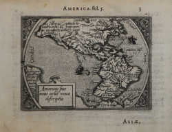
Americae sive novi Orbis nova descriptio Abraham ORTELIUS - Philip GALLE Code: S33909 Measures: 110 x 80 mm Year: 1577 ca. Printed: Antwerpen Price €400.00 Quick view View Details
Le nouveau Monde Barent LANGENES Code: S50508 Measures: 120 x 85 mm Year: 1598 ca. Printed: Amsterdam Price €500.00 Quick view View Details
America Jodocus HONDIUS Jr. Code: MS2165 Measures: 135 x 97 mm Year: 1616 ca. Printed: Amsterdam Price €400.00 Quick view View Details
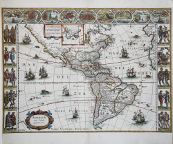
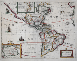
Americae Nova Tabula Willem Janszoon BLAEU Code: S48883 Measures: 550 x 410 mm Year: 1618 ca. Printed: Amsterdam Price €4,000.00 Quick view View Details
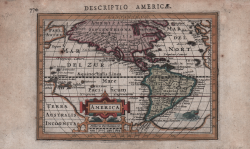
Americae Descriptio Johannes JANSSONIUS Code: S48202 Measures: 203 x 145 mm Year: 1628 ca. Printed: Amsterdam Price €650.00 Quick view View Details
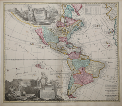
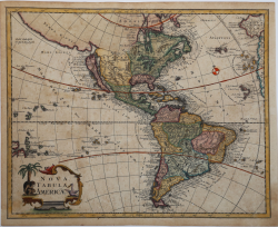
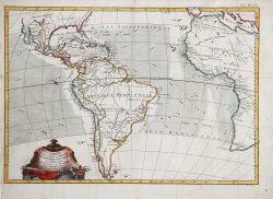
America Noviter Delineata Pierre MARIETTE Code: S33573 Measures: 475 x 365 mm Year: 1650 ca. Printed: Paris Price €2,000.00 Quick view View Details
L'Amerique Pierre DUVAL Code: s39995.1 Measures: 120 x 100 mm Year: 1656 ca. Printed: Paris Price €375.00 Quick view View Details
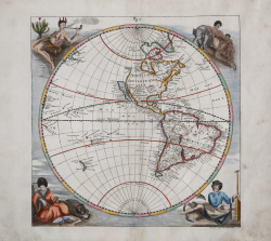
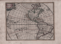
Western Hemisphere Eberhard Werner Happel Code: ms5300 Measures: 290 x 290 mm Year: 1687 Printed: Ulm Price €1,300.00 Quick view View Details
Americae tam Septentrionalis quam Meridionalis in Mappa Geographica... Adam Friedrich ZURNER Code: S39549 Measures: 590 x 505 mm Year: 1709 ca. Printed: Amsterdam Price €1,500.00 Quick view View Details
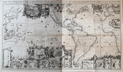
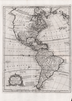
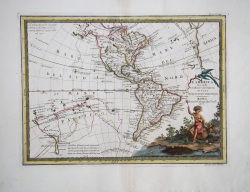
Carte Tres Curieuse de la Mer du Sud, Contenant des Remarques... Henri Abraham CHATELAIN Code: A54486 Measures: 1440 x 830 mm Year: 1719 Printed: Amsterdam Price €10,500.00 Quick view View Details
Nova tabula Americae Georg Christian Kilian Code: S36118 Measures: 340 x 275 mm Year: 1720 ca. Printed: Ausburg Price €1,000.00 Quick view View Details
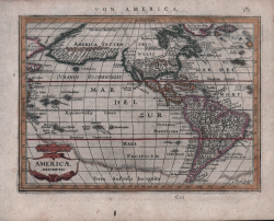
America Philipp CLUVER Code: S48069 Measures: 260 x 210 mm Year: 1729 Printed: Amsterdam Price €325.00 Quick view View Details
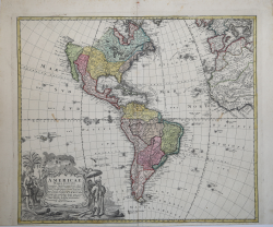
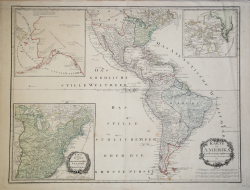
Americae Mappa Generalis Eredi Johannes Baptiste HOMANN Code: AM204 Measures: 565 x 485 mm Year: 1746 Printed: Nurnberg Price €600.00 Quick view View Details
Nuova ed esatta carta della America Ricavata dalle Mappe, e Carte... Marco COLTELLINI Code: s34908 Measures: 285 x 360 mm Year: 1763 Printed: Leghorn Price €350.00 Quick view View Details
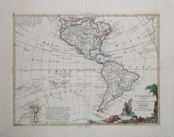
Carte pour servir a l'Histoire Philosophique et Politique des... Rigobert BONNE Code: S45975 Measures: 500 x 360 mm Year: 1773 Printed: Paris Price €270.00 Quick view View Details
L'Amérique divisée en ses principaux Etats Francesco & Paolo SANTINI Code: S52994 Measures: 684 x 515 mm Year: 1780 ca. Printed: Venice Price €450.00 Quick view View Details
L'America secondo le ultime osservazioni divisa ne' suoi stati... Giovanni Maria CASSINI Code: s31409 Measures: 475 x 350 mm Year: 1788 Printed: Rome Price €650.00 Quick view View Details
A New Map of the Whole Continent of America. Divided Into North and... Robert SAYER & John BENNETT Code: S35613 Measures: 1200 x 1050 mm Year: 1794 Printed: London Price €1,750.00 Quick view View Details
Karte von Amerika Franz Johann von REILLY Code: ms2172 Measures: 790 x 620 mm Year: 1795 ca. Printed: Wien Price €750.00 Quick view View Details
L' America divisa ne suoi principali Stati Antonio ZATTA Code: MS6444 Measures: 415 x 315 mm Year: 1796 Printed: Venice Price €575.00 Quick view View Details