| Reference: | MS1283 |
| Author | Henri Abraham CHATELAIN |
| Year: | 1708 ca. |
| Zone: | Jakarta |
| Printed: | Amsterdam |
| Measures: | 375 x 220 mm |
| Reference: | MS1283 |
| Author | Henri Abraham CHATELAIN |
| Year: | 1708 ca. |
| Zone: | Jakarta |
| Printed: | Amsterdam |
| Measures: | 375 x 220 mm |
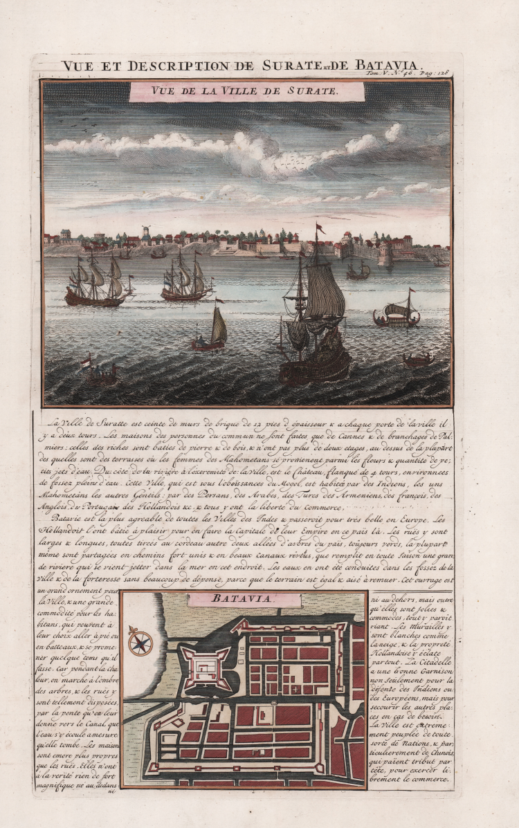
Attractive view of the town and harbor of Surate on the northwest coast of India, and a bird's-eye city plan of Batavia (Jakarta) present-day capital of Indonesia, from Chatelain's monumental 7 volume Atlas Historique, published in Amsterdam.
Surate was the first English trading post in India and was known as a gold and textile center. Batavia was the capital of the Dutch East Indian trading empire during the period when the Dutch dominated trade from the famous Spice Islands.
Henri Abraham Chatelain (1684 - 1743) was a Huguenot pastor of Parisian origins. He is best known as a Dutch cartographer and more specifically for his cartographic contribution in the seminal seven volume Atlas Historique, published in Amsterdam between 1705 and 1720. Innovative for its time, the Atlas Historique combined fine engraving and artwork with scholarly studies of geography, history, ethnology, heraldry, and cosmography. Some scholarship suggests that the Atlas Historique was not exclusively compiled by Henri Chatelain, as is commonly believed, but rather was a family enterprise involving Henri, his father Zacharie and his brother, also Zacharie.
Copper engraving, with fine later hand colour, in excellent condition.
Henri Abraham CHATELAIN (1684 - 1743)
|
Henri Abraham Chatelain (1684 - 1743) was a Huguenot pastor of Parisian origins. He is best known as a Dutch cartographer and more specifically for his cartographic contribution in the seminal seven volume Atlas Historique, published in Amsterdam between 1705 and 1720. Innovative for its time, the Atlas Historique combined fine engraving and artwork with scholarly studies of geography, history, ethnology, heraldry, and cosmography. Some scholarship suggests that the Atlas Historique was not exclusively compiled by Henri Chatelain, as is commonly believed, but rather was a family enterprise involving Henri, his father Zacharie and his brother, also Zacharie. The Atlas Historique published by Chatelain was part of a major work of its time, an encyclopaedia in seven volumes including geography as one of its main subjectes. The text was by Nicholas Gueudeville and the maps by Chatelain. The Atlas included one of the finest maps of America (4 sheets) surrounded by vignettes and decorative insets.
1705-20 Atlas Historique:Amsterdam (maps by Chatelain based on G.Delisle)
Further issues to 1739
|