| Reference: | S52522 |
| Author | Giocondo Regazzoni |
| Year: | 1863 |
| Zone: | The World |
| Printed: | Milan |
| Measures: | 1060 x 810 mm |
| Reference: | S52522 |
| Author | Giocondo Regazzoni |
| Year: | 1863 |
| Zone: | The World |
| Printed: | Milan |
| Measures: | 1060 x 810 mm |
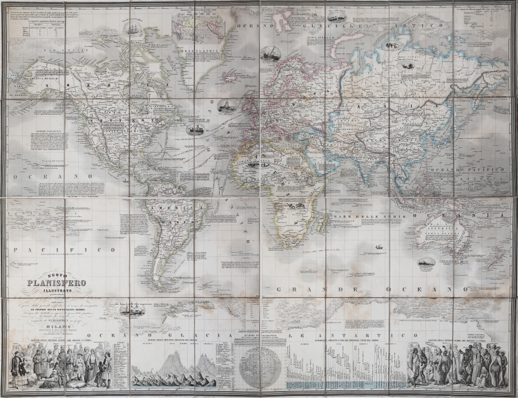
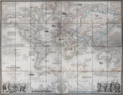
Nuovo planisfero illustrato presentante la descrizione geografica delle parti conosciute della terra indicante l'epoca delle grandi scoperte il nome dei navigatori le colonie delle differenti Nazioni il corso dei battelli a vapore l'epoca delle partenze naturale la durata dei tragitti eseguito da Vuilllemin geografo... Milano presso l'incisore ed editore Giocondo Regazzoni Corso di Porta Orientale n. 1632 e presso Ferdinando Artaria e figlio.
Extremely rare and magnificent wall map of the world from 1863, made according to the Mercator projection, published in Milan by Giocondo Regazzoni.
It is based on the Planisphère Illustré présentant la description géographique des parties connues de la Terre indiquant l'époque des grandes decouverteset le nom des navigateurs, les Coloniess des Diverses Nations ainsi que le percours des bateaux à vapeur, l'époque des départs, la durée du trajet, etc. by French cartographer Alexandre Vuillemin, printed in Paris in 1851. We can define it as the Italian version of Vuillemin's map.
It depicts the world in extraordinary detail, with numerous decorative embellishments and numerous annotations. It features decorative vignettes, ranging from whaling ships on the open sea to Eskimos hunting in the Arctic to armies of horsemen battling across the Sahara. In the American Northwest, some of Lewis and Clark's recent discoveries are recorded, and an attempt is made to note the various Native American tribes of the region. Alaska is called "Russian America." The Arctic and Antarctic ice sheets are beautifully and decoratively depicted in profile. Nautical routes between major cities are indicated. There are also countless historical and textual annotations throughout the map, referencing various expeditions, the discovery of islands by European explorers, and other historical events. The lower part of the map features two engravings depicting traditional consumption habits from various world cultures, along with a table comparing the altitudes of the world's mountains and another comparing the lengths of its rivers. All text has been translated into Italian.
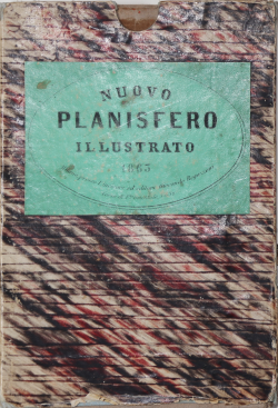
Etching, printed on contemporary paper, mounted on canvas, and cut into squares, folded several times and housed in a contemporary marbled paper case. Origina outline colour, in excellent condition.
Extremely rare map. The only institutional copy is preserved at the Bertarelli Collection in Milan.
Giocondo Regazzoni (attivo dal 1818 al 1870)
|
Engraver and publisher. He worked in Parma and Milan from 1818 to 1870 ca.
|
Giocondo Regazzoni (attivo dal 1818 al 1870)
|
Engraver and publisher. He worked in Parma and Milan from 1818 to 1870 ca.
|