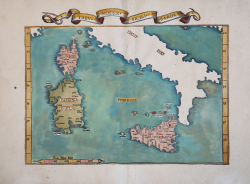
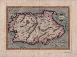
Tabu. Moder. Sicili & Sardi. Laurent FRIES Code: MMS813 Measures: 535 x 375 mm Year: 1522 ca. Printed: Lyon Price €775.00 Quick view View Details
Tabula VII Europae Laurent FRIES Code: S40284 Measures: 555 x 410 mm Year: 1525 Printed: Strasbourg Price €1,200.00 Quick view View Details
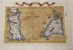
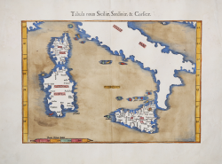
Tabula nova Siciliae, Sardiniae, & Corsicae Laurent FRIES Code: s35047 Measures: 402 x 277 mm Year: 1541 Printed: Vienne Price €1,000.00 Quick view View Details
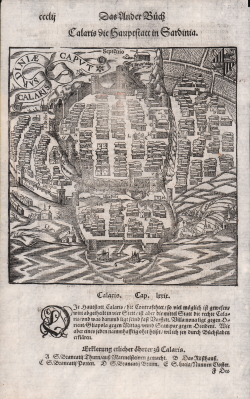
Calaris die Hauptstatt in Sardinia Sebastian Münster Code: S46057 Measures: 175 x 185 mm Year: 1550 ca. Printed: Basle Price €225.00 Quick view View Details
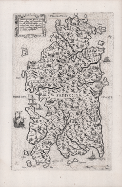
Sardegna Fabio LICINIO Code: S38542 Measures: 195 x 300 mm Year: 1560 ca. Printed: Venice Price €2,000.00 Quick view View Details
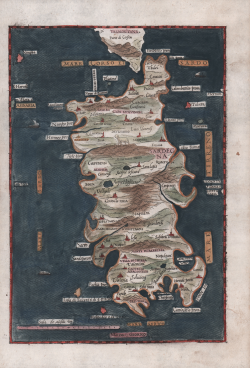
Sardinia jnsula inter africu[m] et tirrenum pelagus sita... Ferrando BERTELLI Code: s30329 Measures: 185 x 298 mm Year: 1562 Printed: Venice Price €5,500.00 Quick view View Details
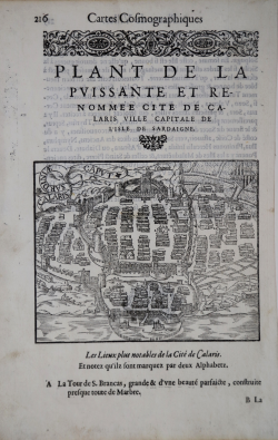
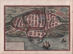
Plant de la puissante et renommee cite de Calaris ville capitale de... Antoine Du PINET Code: s32706 Measures: 160 x 127 mm Year: 1564 Printed: Lyon Price €600.00 Quick view View Details
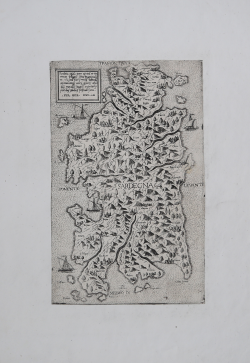
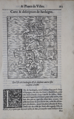
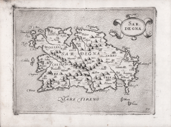
Carte & description de Sardaigne Antoine Du PINET Code: s32705 Measures: 130 x 160 mm Year: 1564 Printed: Lyon Price €900.00 Quick view View Details
Sardegna Giovanni Francesco CAMOCIO Code: s32708 Measures: 222 x 165 mm Year: 1571 ca. Printed: Venice Price €2,200.00 Quick view View Details
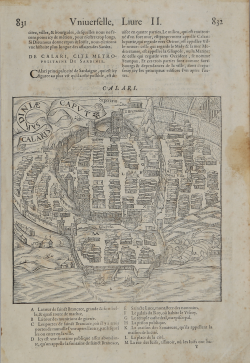
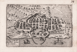
Calaris Georg BRAUN & Franz HOGENBERG Code: S39451 Measures: 230 x 160 mm Year: 1572 Printed: Antwerpen & Cologne Price €225.00 Quick view View Details
Calaris Sardiniae Caput Francois de BELLEFOREST Code: S11285 Measures: 180 x 175 mm Year: 1575 Printed: Paris Price €275.00 Quick view View Details
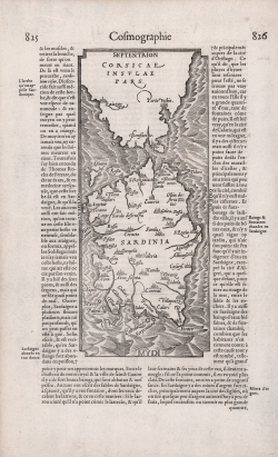
(Corsicae Insulae Pars, Sardinia) Francois de BELLEFOREST Code: S32709 Measures: 215 x 350 mm Year: 1575 Printed: Antwerpen Price €575.00 Quick view View Details
Caliari Francesco VALEGIO Code: S9533 Measures: 130 x 85 mm Year: 1580 ca. Printed: Venice Price €300.00 Quick view View Details
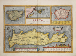
Creta Iovis magni, medio iacet insula ponto Abraham ORTELIUS Code: S44126 Measures: 490 x 340 mm Year: 1584 ca. Printed: Antwerpen Price €500.00 Quick view View Details
Sardegna Leandro ALBERTI Code: s32707 Measures: 170 x 245 mm Year: 1588 Printed: Venice Price €700.00 Quick view View Details
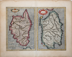
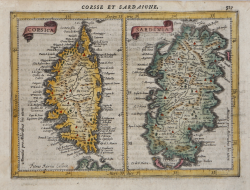
Corsica & Sardinia Gerard MERCATOR (Kremer) Code: s23433 Measures: 465 x 345 mm Year: 1589 ca. Printed: Amsterdam Price €875.00 Quick view View Details
Sardinia Mattheus QUAD Code: s32712 Measures: 285 x 200 mm Year: 1592 ca. Printed: Cologne Price €600.00 Quick view View Details
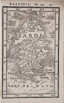
Sardinia Anonimo Code: s32711 Measures: 77 x 124 mm Year: 1595 Printed: Basle Price €575.00 Quick view View Details
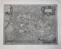
Isola di Sardegna Giovanni Antonio MAGINI Code: S21841 Measures: 460 x 347 mm Year: 1605 ca. Printed: Bologna Price €800.00 Quick view View Details
Corsica & Sardinia Jodocus HONDIUS Code: s23550 Measures: 195 x 140 mm Year: 1607 ca. Printed: Amsterdam Price €225.00 Quick view View Details