Palmira città Regia Giacomo Filippo FORESTI Code: S20750 Measures: 75 x 60 mm Year: 1513 ca. Printed: Venice Price €100.00 Quick view View Details
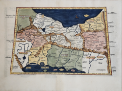
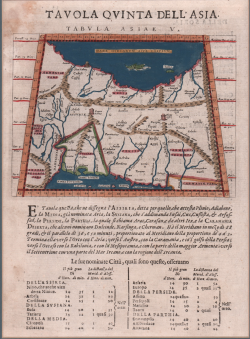
Tabula V. Asiae Laurent FRIES Code: S38208 Measures: 410 x 550 mm Year: 1525 Printed: Strasbourg Price €700.00 Quick view View Details
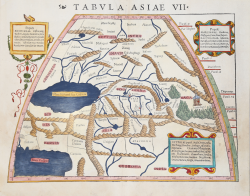
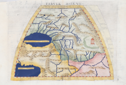
Tabula Asiae VII Sebastian Münster Code: S13434 Measures: 370 x 285 mm Year: 1540 ca. Printed: Basle Price €300.00 Quick view View Details
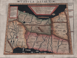
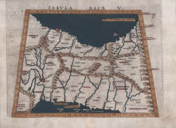
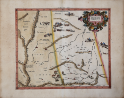
Tabula Asiae V Sebastian Münster Code: S32247 Measures: 380 x 285 mm Year: 1540 ca. Printed: Basle Price €300.00 Quick view View Details
Tabula Asiae VII Girolamo RUSCELLI Code: S11444 Measures: 260 x 190 mm Year: 1561 ca. Printed: Venice Price €150.00 Quick view View Details
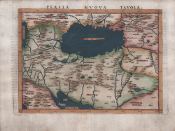
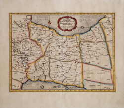
Persia Nuova Tavola Girolamo RUSCELLI Code: S49640 Measures: 270 x 190 mm Year: 1561 ca. Printed: Venice Price €300.00 Quick view View Details
Tabula Asiae V Girolamo RUSCELLI Code: MS1720 Measures: 260 x 205 mm Year: 1561 ca. Price €225.00 Quick view View Details
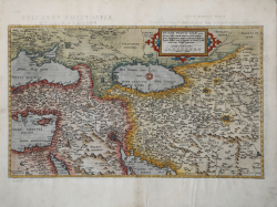
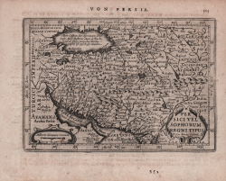
Percici sive Sophoru Regni Typus Abraham ORTELIUS - Philip GALLE Code: s33936 Measures: 107 x 80 mm Year: 1577 ca. Printed: Antwerpen Price €150.00 Quick view View Details
Primae Partis Asiae... Gerard DE JODE Code: S42311 Measures: 510 x 300 mm Year: 1578 ca. Printed: Antwerpen Price €2,250.00 Quick view View Details
Asiae VIII Tab. Gerard MERCATOR (Kremer) Code: S10144 Measures: 410 x 350 mm Year: 1578 ca. Printed: Amsterdam Price €350.00 Quick view View Details
Asiae VII Tab. Gerard MERCATOR (Kremer) Code: S10143 Measures: 470 x 355 mm Year: 1578 ca. Printed: Amsterdam Price €380.00 Quick view View Details
Tabula Asiae V Giovanni Antonio MAGINI Code: S5130 Measures: 180 x 135 mm Year: 1596 Printed: Venice Price €175.00 Quick view View Details
Persici Vel Sophorum Regni Typus Johannes JANSSONIUS Code: S48187 Measures: 190 x 132 mm Year: 1628 ca. Printed: Amsterdam Price €180.00 Quick view View Details
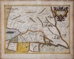
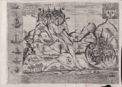
Margat Henri RAIGNAULD Code: S40335.4 Measures: 270 x 200 mm Year: 1629 Printed: Paris Price €350.00 Quick view View Details
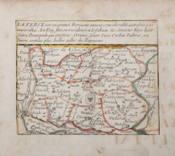
La Perse… Pierre DUVAL Code: S39995.30 Measures: 122 x 100 mm Year: 1656 ca. Printed: Paris Price €200.00 Quick view View Details
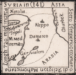
Suria in Asia Casimiro FRESCHOT Code: S46670 Measures: 50 x 50 mm Year: 1665 ca. Printed: Venice Price €300.00 Quick view View Details
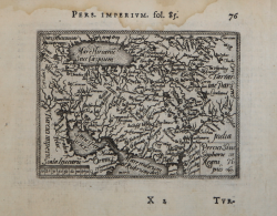
Tab. V Asiae, Repraesentans Mediam, Hyrcaniam, Assyriam, Susianam,... Gerard MERCATOR (Kremer) Code: MS4931 Measures: 465 x 350 mm Year: 1695 ca. Printed: Amsterdam Price €325.00 Quick view View Details
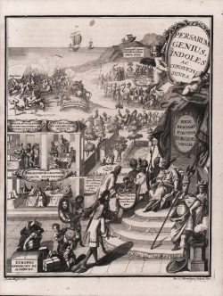
Persarum Genius, Indoles ac Consuetudines Henrick SCHERER Code: MS5732 Measures: 195 x 245 mm Year: 1703 ca. Price €180.00 Quick view View Details
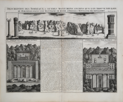
Description Des Tombeaux & Autres Monumens Anciens que l'On Trouve... Henri Abraham CHATELAIN Code: ms2654 Measures: 495 x 380 mm Year: 1708 Printed: Amsterdam Price €225.00 Quick view View Details
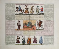
Description des Habits des Persans, tant des Hommes que des Femmes,... Henri Abraham CHATELAIN Code: ms2653 Measures: 442 x 385 mm Year: 1710 Printed: Amsterdam Price €200.00 Quick view View Details