| Reference: | S42311 |
| Author | Gerard DE JODE |
| Year: | 1578 ca. |
| Zone: | Persia |
| Printed: | Antwerpen |
| Measures: | 510 x 300 mm |
| Reference: | S42311 |
| Author | Gerard DE JODE |
| Year: | 1578 ca. |
| Zone: | Persia |
| Printed: | Antwerpen |
| Measures: | 510 x 300 mm |
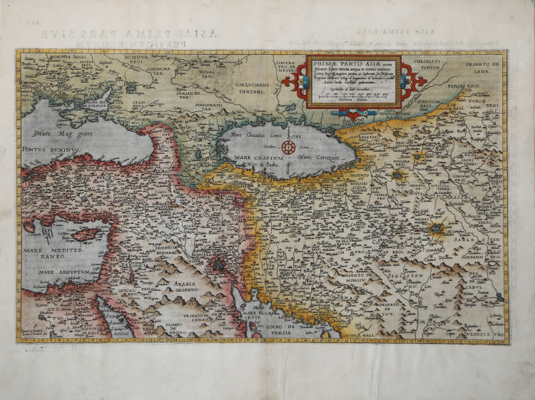
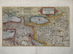
A nice example of De Jode's map of the region, bounded by the Black Sea and Mediterranean in the West and Afghanistan and Central Asia in the East. Cyprus is prominently shown in the Eastern Mediterranean.
This map was engraved by the van Deutecum brothers and is based upon Giacomo Gastaldi's highly influential 2 sheet map of the region, La Descrittione Della Prima Parte Dell' Asia ... first published by Gastaldi in Venice in 1561. Gastaldi's map is the single most influential map of the region published in the 16th Century. The map would go on to be the most influential map of the region and the pro-type for the region well into the early 17th Century.
Geard De Jode was a contemporary of Ortelius. His Speculum Orbis did not enjoy the same commercial success as Ortelius, making his maps very scarce and highly desirable.
|
Gerard de Jode, born in Nijmegen, was a cartographer, engraver, printer and publisher in Antwerp, issuing maps from 1555 more or less in the same period as Ortelius. He was never able to offer very serious competition to his more businesslike rival although, ironically, he published Ortelius's famous 8-sheet World Map in 1564.
His major atlas, now extremely rare, could not be published until 1578, eight years after the Theatrum, Ortelius having obtained a monopoly for that period. The enlarged re-issue by his son in 1593 is more frequently found. On the death of Cornelis, the copper plates passed to J. B. Vrients (who bought the Ortelius plates about the same time) and apparently no further issue of the atlas was published: however, at least one further issue of the Polar Map, c.1618, is known.
Son of Gerard de Jode, who was a cartographer, engraver, printer and publisher in Antwerp, issuing maps from 1555 more or less in the same period as Ortelius.
Gerard de Jode's major atlas, now extremely rare, could not be published until 1578, eight years after the Theatrum, Ortelius having obtained a monopoly for that period. The enlarged re-issue by his Cornelis in 1593 is more frequently found.
On the death of Cornelis, the copper plates passed to J. B. Vrients (who bought the Ortelius plates about the same time) and apparently no further issue of the atlas was published: however, at least one further issue of the Polar Map, c.1618, is known.
|
|
Gerard de Jode, born in Nijmegen, was a cartographer, engraver, printer and publisher in Antwerp, issuing maps from 1555 more or less in the same period as Ortelius. He was never able to offer very serious competition to his more businesslike rival although, ironically, he published Ortelius's famous 8-sheet World Map in 1564.
His major atlas, now extremely rare, could not be published until 1578, eight years after the Theatrum, Ortelius having obtained a monopoly for that period. The enlarged re-issue by his son in 1593 is more frequently found. On the death of Cornelis, the copper plates passed to J. B. Vrients (who bought the Ortelius plates about the same time) and apparently no further issue of the atlas was published: however, at least one further issue of the Polar Map, c.1618, is known.
Son of Gerard de Jode, who was a cartographer, engraver, printer and publisher in Antwerp, issuing maps from 1555 more or less in the same period as Ortelius.
Gerard de Jode's major atlas, now extremely rare, could not be published until 1578, eight years after the Theatrum, Ortelius having obtained a monopoly for that period. The enlarged re-issue by his Cornelis in 1593 is more frequently found.
On the death of Cornelis, the copper plates passed to J. B. Vrients (who bought the Ortelius plates about the same time) and apparently no further issue of the atlas was published: however, at least one further issue of the Polar Map, c.1618, is known.
|