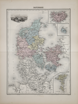
Danemark Louis Edouard Desbuissons Code: A53123 Measures: 390 x 520 mm Year: 1872 ca. Printed: Paris Price €100.00 Quick view View Details
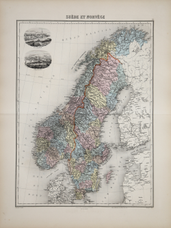
Suède et Norvège Louis Edouard Desbuissons Code: A53122 Measures: 390 x 515 mm Year: 1872 ca. Printed: Paris Price €100.00 Quick view View Details
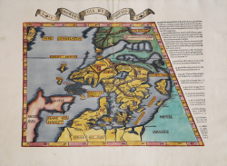
Norbegia et Gottia Laurent FRIES Code: S48882 Measures: 560 x 410 mm Year: 1535 Printed: Strasbourg Price €2,800.00 Quick view View Details
La Description de Gotthie ou de Gottlande Sebastian Münster Code: S48027 Measures: 135 x 98 mm Year: 1552 Printed: Basle Price €225.00 Quick view View Details
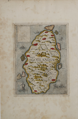
Gotlandia Antonio LAFRERI Code: S38509 Measures: 195 x 255 mm Year: 1570 ca. Printed: Rome Price €2,800.00 Quick view View Details
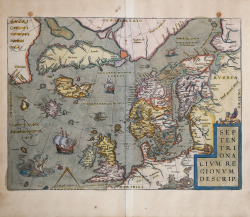
Septentrionalium Regionum Descrip[tio] Abraham ORTELIUS Code: S46073 Measures: 490 x 365 mm Year: 1570 ca. Printed: Antwerpen Price €2,800.00 Quick view View Details
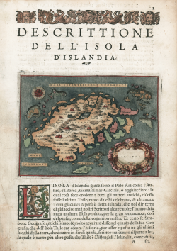
Descrittione dell'isola d'Islanda Tommaso PORCACCHI Code: S45122 Measures: 150 x 110 mm Year: 1572 ca. Printed: Venice Price €425.00 Quick view View Details
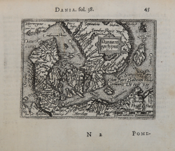
Daniae Regni typus Abraham ORTELIUS - Philip GALLE Code: s33927 Measures: 107 x 80 mm Year: 1577 ca. Printed: Antwerpen Price €100.00 Quick view View Details
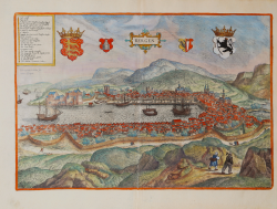
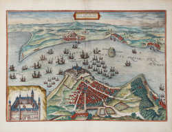
Bergen Georg BRAUN & Franz HOGENBERG Code: S49238.208 Measures: 475 x 325 mm Year: 1581 ca. Printed: Antwerpen & Cologne Price €550.00 Quick view View Details
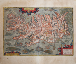
Islandia Abraham ORTELIUS Code: S48762 Measures: 495 x 345 mm Year: 1587 ca. Printed: Antwerpen Price €12,500.00 Quick view View Details
Tipographia Insulae Huenae in celebri porthmo Daniae, quem Vulgo... Georg BRAUN & Franz HOGENBERG Code: S49238.55 Measures: 480 x 34 mm Year: 1588 Printed: Antwerpen & Cologne Price €1,000.00 Quick view View Details
Freti Danici or sundt Accuratiss Delineatio Georg BRAUN & Franz HOGENBERG Code: S49238.150 Measures: 477 x 330 mm Year: 1588 ca. Printed: Antwerpen & Cologne Price €800.00 Quick view View Details
Stockholm / Stocholm Georg BRAUN & Franz HOGENBERG Code: S49238.34 Measures: 470 x 325 mm Year: 1588 ca. Printed: Antwerpen & Cologne Price €1,400.00 Quick view View Details
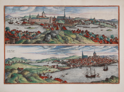
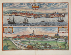
Elsenor / Ripen Georg BRAUN & Franz HOGENBERG Code: S49238.171 Measures: 475 x 340 mm Year: 1597 ca. Printed: Antwerpen & Cologne Price €600.00 Quick view View Details
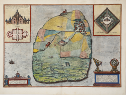
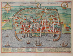
Visbia Gothorum Georg BRAUN & Franz HOGENBERG Code: S49238.172 Measures: 492 x 365 mm Year: 1597 ca. Printed: Antwerpen & Cologne Price €750.00 Quick view View Details
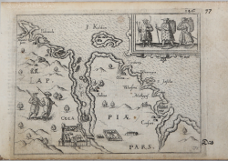
Lappiae Pars Lievin HULSIUS Code: ms3882 Measures: 145 x 110 mm Year: 1604 ca. Printed: Frankfurt Price €200.00 Quick view View Details
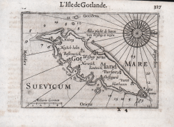
L'Isle de Gotlande Barent LANGENES Code: S50570 Measures: 125 x 85 mm Year: 1609 Printed: Frankfurt Price €150.00 Quick view View Details
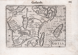
Gotia Barent LANGENES Code: S50666 Measures: 125 x 85 mm Year: 1609 Printed: Frankfurt Price €125.00 Quick view View Details
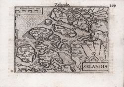
Selandia Barent LANGENES Code: S50546 Measures: 125 x 85 mm Year: 1609 Printed: Frankfurt Price €150.00 Quick view View Details
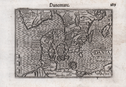
Dania Barent LANGENES Code: S50563 Measures: 125 x 85 mm Year: 1609 Printed: Frankfurt Price €200.00 Quick view View Details