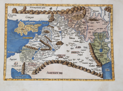
Tabula quarta Asiae complectitur Cyprum insulam, Syriam, Phoniceam,... Laurent FRIES Code: S42976 Measures: 520 x 395 mm Year: 1522 ca. Printed: Vienne Price €875.00 Quick view View Details
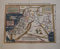
Syria / Cypern / Palestina / Mesopotamia / Babylonia / zwey Arabia... Sebastian Münster Code: S33907 Measures: 355 x 310 mm Year: 1540 ca. Printed: Basle Price €450.00 Quick view View Details
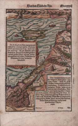
The Holy Land & Cyprus Sebastian Münster Code: MS225 Measures: 170 x 260 mm Year: 1550 ca. Printed: Basle Price €250.00 Quick view View Details
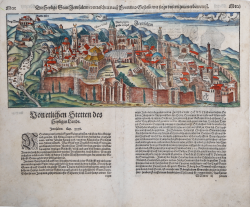
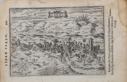
Die heilige statt Jerusalem contrafehtet nach form und gestalt... Sebastian Münster Code: S46061 Measures: 375 x 150 mm Year: 1550 ca. Printed: Basle Price €650.00 Quick view View Details
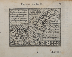
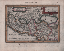
Palestinae sive totius terrae promissionis nova descriptio Abraham ORTELIUS - Philip GALLE Code: S33912 Measures: 108 x 80 mm Year: 1577 ca. Printed: Antwerpen Price €250.00 Quick view View Details
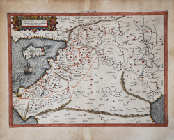
ASIAE IIII TAB. Gerard MERCATOR (Kremer) Code: s34890 Measures: 475 x 350 mm Year: 1578 ca. Printed: Cologne Price €550.00 Quick view View Details
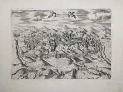
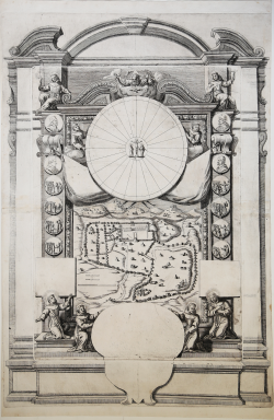
HIERUSALEM Claudio DUCHET (Duchetti) Code: S35111 Measures: 424 x 300 mm Year: 1580 ca. Printed: Rome Price €2,500.00 Quick view View Details
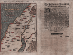
Taffel des Heiligen Landes zu dem nemen Testament dienlich Heinrich BUNTING Code: s30260 Measures: 200 x 280 mm Year: 1581 ca. Printed: Magdeburg Price €350.00 Quick view View Details
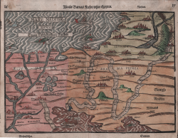
Israels Barnas Reefor sthur Egypten Heinrich BUNTING Code: S11293 Measures: 360 x 260 mm Year: 1581 ca. Printed: Magdeburg Price €550.00 Quick view View Details
Betania Natale BONIFACIO Code: S24205 Measures: 120 x 90 mm Year: 1586 ca. Printed: Venice Price €150.00 Quick view View Details
Vallis Therebinthi Natale BONIFACIO Code: S24201 Measures: 120 x 90 mm Year: 1586 ca. Printed: Venice Price €150.00 Quick view View Details
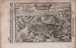
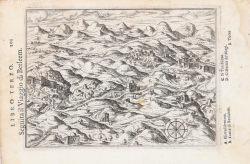
(Viaggio a Betlemme) Natale BONIFACIO Code: S24206 Measures: 125 x 93 mm Year: 1586 ca. Printed: Venice Price €150.00 Quick view View Details
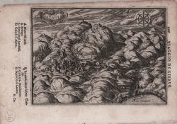
Ramma Natale BONIFACIO Code: S24200 Measures: 123 x 90 mm Year: 1586 ca. Printed: Venice Price €200.00 Quick view View Details
Ierusalem, et suburbia eius, sicut tempore Christi floruit... Georg BRAUN & Franz HOGENBERG Code: S49238.5 Measures: 485 x 735 mm Year: 1588 ca. Printed: Antwerpen & Cologne Price Not Available Quick view View Details New
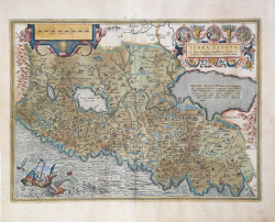
Terra Sancta Abraham ORTELIUS Code: S46127 Measures: 505 x 370 mm Year: 1595 ca. Printed: Antwerpen Price €800.00 Quick view View Details
Terra Sancta quae in Sacris Terra Promissionis ol. Palestina Johannes JANSSONIUS Code: S48186 Measures: 195 x 135 mm Year: 1628 ca. Printed: Amsterdam Price €280.00 Quick view View Details
Jerusalem Anonimo Code: S29197 Measures: 475 x 695 mm Year: 1630 ca. Price Not Available Quick view View Details
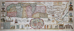
Chorographia Terrae Sanctae in Angustiorem Formam Redacta et ex... Jacobi TIRINI Code: S48932 Measures: 820 x 330 mm Year: 1632 ca. Price €1,000.00 Quick view View Details
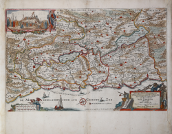
Geographische beschryvinge van T'Beloofde-Landt Canaan... Claes Jansz. VISSCHER Code: S46337 Measures: 475 x 305 mm Year: 1642 ca. Printed: Amsterdam Price €450.00 Quick view View Details
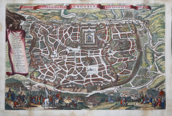
De Heylige en Wytuermaerde Stadt Jerusalem EErst Geneamt Salem Claes Jansz. VISSCHER Code: S46332 Measures: 480 x 320 mm Year: 1645 Printed: Amsterdam Price €575.00 Quick view View Details