| Reference: | S46341 |
| Author | Gerard & Rudolf Wetstein |
| Year: | 1728 |
| Zone: | The Holy Roman Empire |
| Printed: | Amsterdam |
| Measures: | 515 x 365 mm |
| Reference: | S46341 |
| Author | Gerard & Rudolf Wetstein |
| Year: | 1728 |
| Zone: | The Holy Roman Empire |
| Printed: | Amsterdam |
| Measures: | 515 x 365 mm |
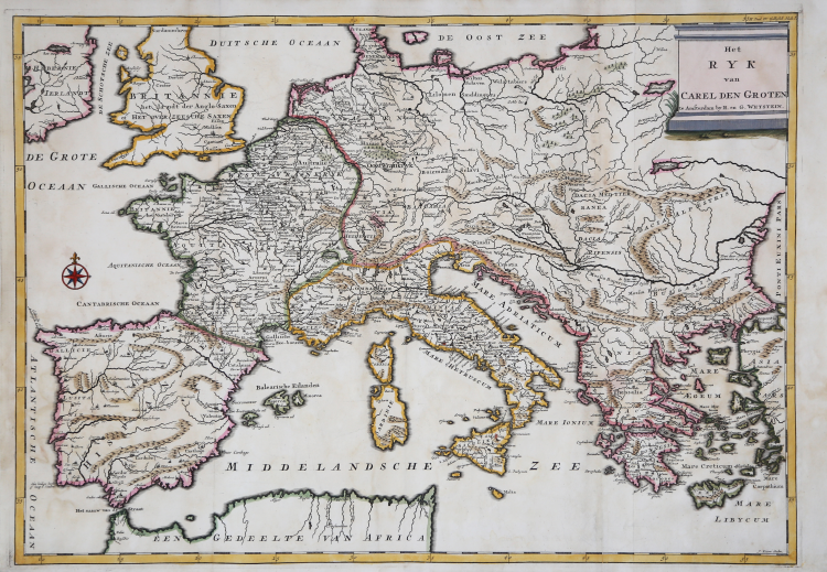
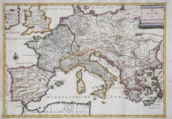
This fine map of Europe describes the Empire of Charlemagne in the Middle Ages. The map is filled with ancient place names and decorated with a simple title cartouche and compass rose.
The map is taken from the Algemene kerkelyke en wereldlyke geschiedenissen des bekenden aard-kloots by Sugars Geerlof and Isaac Verburg, published in 5 volumes. Amsterdam: Gerard and Rudolf Wetstein, 1721-1728.
Etching with fine later hand colour, good condition.
Gerard & Rudolf Wetstein (Amsterdam 1680 - 1755)
|
Bookseller, in Amsterdam 1701-36. Partner of his brother Rudolf Wetstein. From 1727 the brothers were in partnership with William Smith.
|
Gerard & Rudolf Wetstein (Amsterdam 1680 - 1755)
|
Bookseller, in Amsterdam 1701-36. Partner of his brother Rudolf Wetstein. From 1727 the brothers were in partnership with William Smith.
|