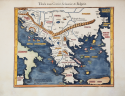
Tabula nova Graeciae, Sclavoniae, & Bulgariae Laurent FRIES Code: S43124 Measures: 405 x 320 mm Year: 1522 ca. Printed: Vienne Price €875.00 Quick view View Details
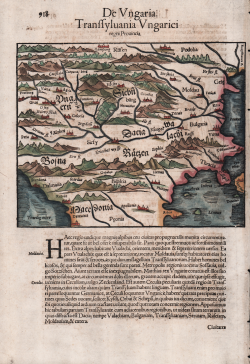
De Ungaria. Transsyluania Ungarici regni Provincia Sebastian Münster Code: ms6333 Measures: 190 x 150 mm Year: 1550 ca. Printed: Basle Price €180.00 Quick view View Details
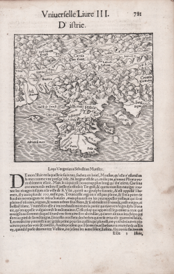
D'istrie Sebastian Münster Code: S48032 Measures: 145 x 142 mm Year: 1552 Printed: Basle Price €180.00 Quick view View Details
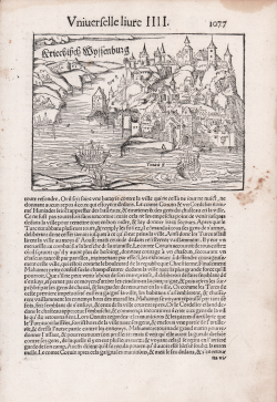
Griechisch Weissenburg [Belgrade] Sebastian Münster Code: S48034 Measures: 157 x 115 mm Year: 1552 Printed: Basle Price €180.00 Quick view View Details
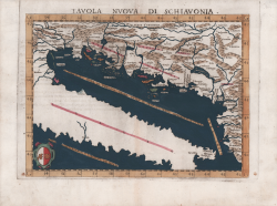
Tavola Nuova di Schiavonia Girolamo RUSCELLI Code: S11476 Measures: 260 x 190 mm Year: 1561 ca. Printed: Venice Price €350.00 Quick view View Details
NOVA DISCRITTIONE DELA DALMATIA, ET CROVATIA. M.D.LXV Paolo FORLANI Code: S39352 Measures: 390 x 275 mm Year: 1565 Printed: Venice Price €4,500.00 Quick view View Details
La vera et fidele descrittione di tutto il Contado di Zara et... Paolo FORLANI Code: S39351 Measures: 401 x 292 mm Year: 1566 ca. Printed: Venice Price €3,500.00 Quick view View Details
Descritione dell’Austria, et Ongheria, Transilvania, Baviera,... Domenico ZENOI Code: S38501 Measures: 195 x 151 mm Year: 1567 Printed: Venice Price €2,000.00 Quick view View Details
Dvlcigno già vicinio città antiqua posta nel confine della dalmatia... Domenico ZENOI Code: S26277 Measures: 200 x 155 mm Year: 1568 ca. Printed: Venice Price €600.00 Quick view View Details
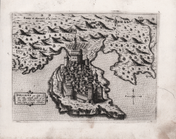
Scutari Domenico ZENOI Code: S26278 Measures: 210 x 150 mm Year: 1568 ca. Printed: Venice Price €500.00 Quick view View Details
Antivari Città in cofine con la Dalmatia et Albania loco della... Domenico ZENOI Code: S26279 Measures: 205 x 150 mm Year: 1568 ca. Printed: Venice Price €600.00 Quick view View Details
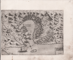
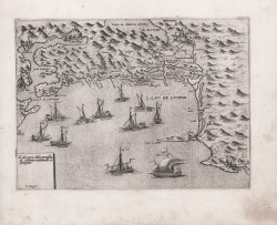
Valona, Città e porto nella provintia et confim di Albania al... Domenico ZENOI Code: S26281 Measures: 205 x 150 mm Year: 1568 ca. Printed: Venice Price €600.00 Quick view View Details
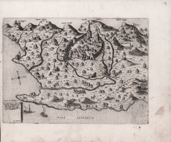
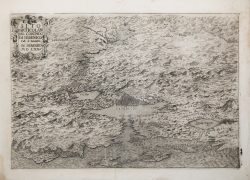
Il disegno dela provintia di Albania, novamente ristampato Domenico ZENOI Code: S262710 Measures: 200 x 150 mm Year: 1568 ca. Printed: Venice Price €600.00 Quick view View Details
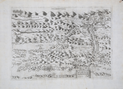
Sito particolare del contado di Sebenico parte di Dalmatia Natale BONIFACIO Code: S39349 Measures: 430 x 290 mm Year: 1570 Printed: Venice Price €8,000.00 Quick view View Details
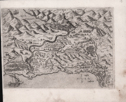
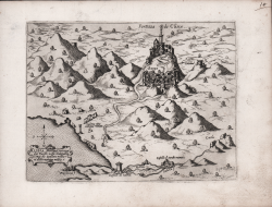
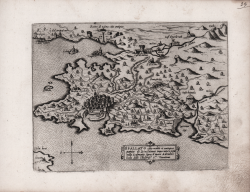
Clissa principal fortezza del Turcho nella Dalmatia longi da... Giovanni Francesco CAMOCIO Code: S22273 Measures: 205 x 155 mm Year: 1570 ca. Printed: Venice Price €450.00 Quick view View Details
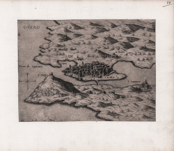
Osero Giovanni Francesco CAMOCIO Code: S22269 Measures: 210 x 155 mm Year: 1570 ca. Printed: Venice Price €380.00 Quick view View Details
Spalatto citta nobile et antiqua patria di Diocletiano imperatore... Giovanni Francesco CAMOCIO Code: S22272 Measures: 200 x 155 mm Year: 1570 ca. Printed: Venice Price €500.00 Quick view View Details
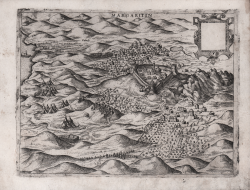
Margaritin Giovanni Francesco CAMOCIO Code: s30290 Measures: 225 x 170 mm Year: 1570 ca. Printed: Venice Price €300.00 Quick view View Details
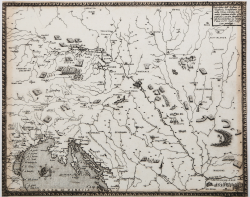
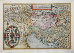
Nova exactissimaque descriptio Danubii Gerard DE JODE Code: S27948 Measures: 500 x 340 mm Year: 1570 ca. Printed: Antwerpen Price €2,500.00 Quick view View Details
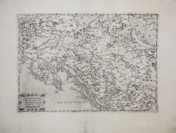
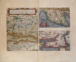
Carinthiae Dvcatvs, et Goritiae Palatinatvs, Wolf. Lazio Abraham ORTELIUS Code: ms35270 Measures: 490 x 330 mm Year: 1570 ca. Printed: Antwerpen Price €450.00 Quick view View Details