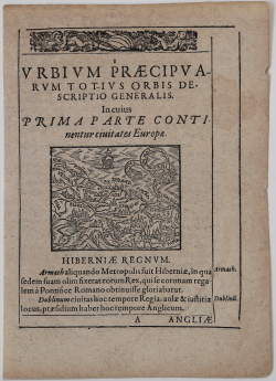
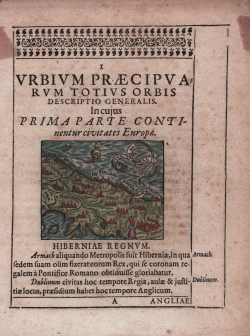
Urbium Praecipuarum Totius Orbis Descriptio Generalis. Incujus...
Adrian van Roomen
Code:
CO-234
Measures:
68 x 55 mm
Year:
1595
Printed:
Frankfurt
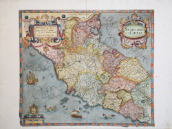
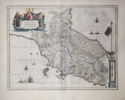
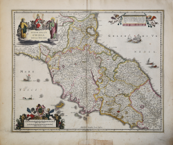
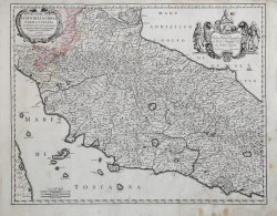
Stato della Chiesa
Giovanni Antonio MAGINI
Code:
CO-133
Measures:
430 x 375 mm
Year:
1607 ca.
Printed:
Bologna
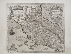
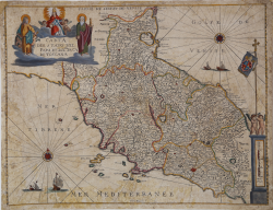
Stato della Chiesa
Giovanni Antonio MAGINI
Code:
S40982
Measures:
435 x 375 mm
Year:
1607 ca.
Printed:
Bologna
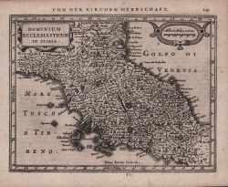
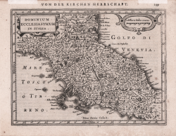
Dominium Ecclesiasticum in Italia
Johannes JANSSONIUS
Code:
S48170
Measures:
205 x 155 mm
Year:
1628 ca.
Printed:
Amsterdam
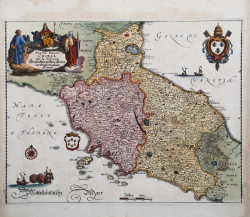
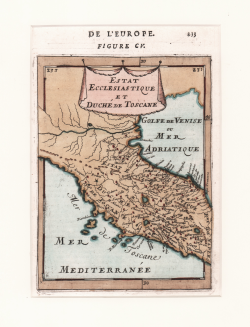
Stato della Chiesa con la Toscana
Willem Janszoon BLAEU
Code:
S43686
Measures:
500 x 390 mm
Year:
1634 ca.
Printed:
Amsterdam
Stato della Chiesa. Dominium Ecclesiasticum in Italia
Hendrick HONDIUS
Code:
S29285
Measures:
530 x 420 mm
Year:
1636 ca.
Printed:
Amsterdam
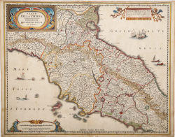
Stato della Chiesa con la Toscana
Matthaus MERIAN "il vecchio"
Code:
CO-140
Measures:
360 x 280 mm
Year:
1640 ca.
Printed:
Frankfurt
Stato della Chiesa con la Toscana
Johannes JANSSONIUS
Code:
MMS992
Measures:
525 x 420 mm
Year:
1640 ca.
Printed:
Amsterdam
Dominium Ecclesiasticum in Italia
Johannes JANSSONIUS
Code:
CO-213
Measures:
205 x 160 mm
Year:
1648 ca.
Printed:
Amsterdam
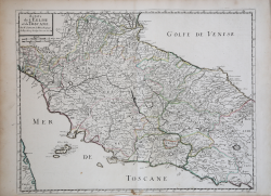
Estats de l'Eglise et de Toscane
Nicolas SANSON
Code:
CO-107
Measures:
565 x 430 mm
Year:
1648
Printed:
Paris
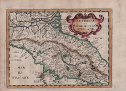
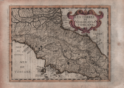
Les Tèrres de l'Eglise et la Toscane
Philippe BRIET
Code:
s29564
Measures:
200 x 150 mm
Year:
1649
Printed:
Paris
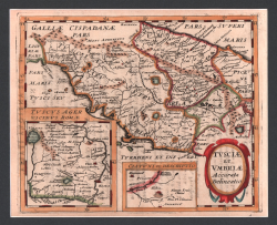
Tusciae et Umbriae Accurata Delineatio
Philippe BRIET
Code:
s29540
Measures:
200 x 160 mm
Year:
1649
Printed:
Paris
Les Terres de l'Eglise et la Toscane
Philippe BRIET
Code:
CO-686
Measures:
195 x 135 mm
Year:
1649
Printed:
Paris
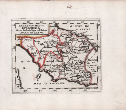
Archeveschez et Eveschez de l'Estat Ecclesiastique et de Toscane
Pierre DUVAL
Code:
CO-707
Measures:
125 x 105 mm
Year:
1662
Printed:
Paris
Archeveschez et Eveschez de l'Estat Ecclesiastique et de Toscane
Pierre DUVAL
Code:
CO-974
Measures:
125 x 105 mm
Year:
1662
Printed:
Paris
Theatrum Civitatum et Admirandorum Italiae ad aevi veteris &...
Johannes BLAEU
Code:
4208
Measures:
- x - mm
Year:
1663
Descrittione dello Stato della Chiesa e della Toscana
Michele Antonio BAUDRAND
Code:
S43972
Measures:
560 x 435 mm
Year:
1669 ca.
Printed:
Rome
Carta del Stato del Papa et del Gra. Duca di Toscana
Pietro TODESCHI
Code:
MS8201
Measures:
490 x 378 mm
Year:
1670 ca.
Printed:
Bologna
Estat Ecclesiastique et Duché de Toscane
Allain Manneson MALLET
Code:
CO-563
Measures:
120 x 160 mm
Year:
1683
Printed:
Paris