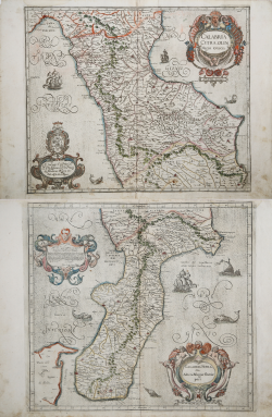
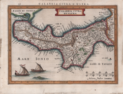
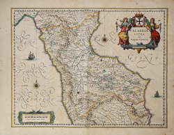
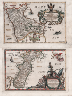
Calabria Citra & Calabria Ultra Giovanni Antonio MAGINI Code: s28107 Measures: - x - mm Year: 1602 ca. Printed: Bologna Price €1,000.00 Quick view View Details
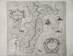
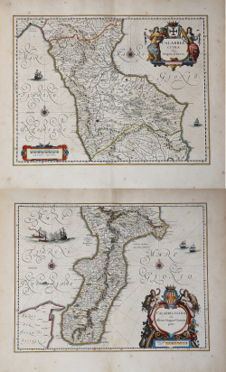
Calabria Ultra, olim Altera Magnae Graeciae pars Giovanni Antonio MAGINI Code: S41006 Measures: 435 x 390 mm Year: 1602 ca. Printed: Bologna Price €500.00 Quick view View Details
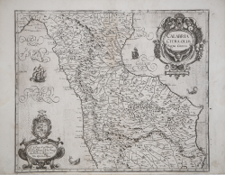
Calabria Citra, Olim Magna Graecia Giovanni Antonio MAGINI Code: S41007 Measures: 455 x 380 mm Year: 1602 ca. Printed: Bologna Price €425.00 Quick view View Details
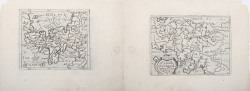
Calabria/Campania Foelix nunc Terra Laboris Cyprian EICHOVIUS Code: s26606 Measures: 130 x 100 mm Year: 1603 ca. Printed: Cologne Price €575.00 Quick view View Details
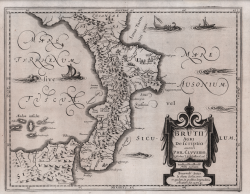
Brutii Agri Descriptio auctore Phil Cluverio Philipp CLUVER Code: S42701 Measures: 360 x 285 mm Year: 1624 Printed: Leyden Price €400.00 Quick view View Details
Calabria Citra et Ultra Jodocus HONDIUS Jr. Code: S46303 Measures: 250 x 180 mm Year: 1627 Printed: Leyden Price €300.00 Quick view View Details
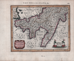
Puglia Piana Terra di Bari Otranto etc Johannes JANSSONIUS Code: S48176 Measures: 180 x 140 mm Year: 1628 ca. Printed: Amsterdam Price €200.00 Quick view View Details
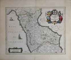
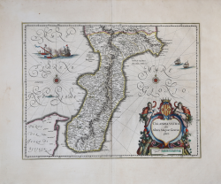
Calabria Citra olim Magna Graecia Johannes JANSSONIUS Code: S21809 Measures: 495 x 385 mm Year: 1636 ca. Printed: Amsterdam Price €400.00 Quick view View Details
Calabria Citra olim Magna Graecia Willem Janszoon BLAEU Code: S10466 Measures: 500 x 380 mm Year: 1640 ca. Printed: Amsterdam Price €375.00 Quick view View Details
Calabria Citra olim Magna Graecia / Calabria Ultra olim Altera... Willem Janszoon BLAEU Code: S50371 Measures: 500 x 380 mm Year: 1640 ca. Printed: Amsterdam Price €1,000.00 Quick view View Details
Calabria Ultra olim Altera Magnae Graeciae pars Willem Janszoon BLAEU Code: A50013 Measures: 500 x 385 mm Year: 1640 ca. Printed: Amsterdam Price €550.00 Quick view View Details
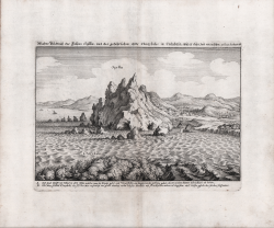
Scylla Matthaus MERIAN "il vecchio" Code: S39868 Measures: 270 x 195 mm Year: 1640 ca. Printed: Frankfurt Price €250.00 Quick view View Details
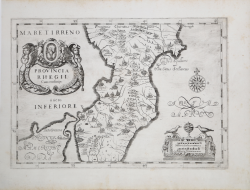
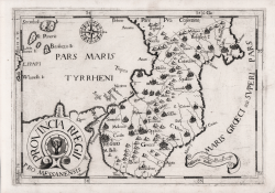
Provincia Rhegii cum Confinijs. Johannes MONTECALERIO Code: S38268 Measures: 322 x 225 mm Year: 1649 Printed: Rome Price €400.00 Quick view View Details
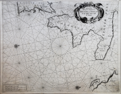
Costa Maritima della parte Orientale di Sicilia et Italia da Cap.... Francesco Maria LEVANTO Code: ms18 Measures: 520 x 405 mm Year: 1664 Printed: Genua Price Not Available Quick view View Details
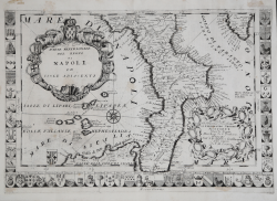
Parte Meridionale del Regno di Napoli ed Isole Adiacenti Vincenzo CORONELLI Code: S52523 Measures: 465 x 320 mm Year: 1690 ca. Printed: Venice Price €900.00 Quick view View Details
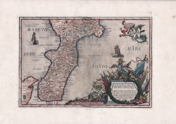
Calabria Ultra Francesco Cassiano De Silva Code: S43568 Measures: 315 x 220 mm Year: 1692 Printed: Naples Price €425.00 Quick view View Details
Calabria Citra / Calabria Ultra Francesco Cassiano De Silva Code: S45352 Measures: - x - mm Year: 1692 Printed: Naples Price €1,000.00 Quick view View Details
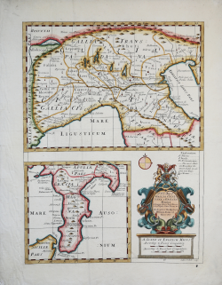
A New Map of Gallia Cisalpina & Graecia Magna Edward WELLS Code: S11286 Measures: 375 x 490 mm Year: 1701 ca. Printed: London Price €400.00 Quick view View Details
Provincia Rhegii Giovanni Battista da Cassine Code: S32067 Measures: 340 x 240 mm Year: 1712 Printed: Milan Price €400.00 Quick view View Details
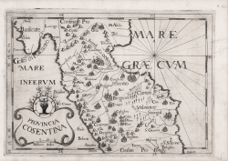
Provincia Cosentina Giovanni Battista da Cassine Code: S32068 Measures: 340 x 240 mm Year: 1712 Printed: Milan Price €400.00 Quick view View Details