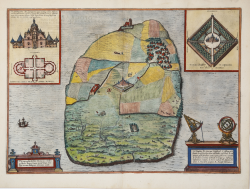
Tipographia Insulae Huenae in celebri porthmo Daniae, quem Vulgo...
Georg BRAUN & Franz HOGENBERG
Code:
S49238.55
Measures:
480 x 34 mm
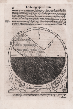
Year:
1588
Printed:
Antwerpen & Cologne
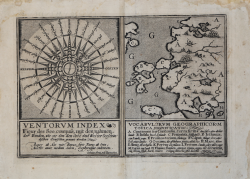
Ventorum index…/ Vocabolorum geographicorum…
Mattheus QUAD
Code:
s20206
Measures:
300 x 200 mm
Year:
1600 ca.
Printed:
Cologne
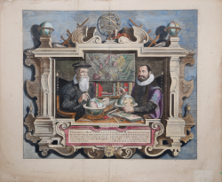
Gerard Mercator & Iodocus Hondius
Jodocus HONDIUS
Code:
S30080
Measures:
450 x 390 mm
Year:
1613 ca.
Printed:
Amsterdam
Hemisphaerii Borealis Coeli et Terrae Sphaerica Scenographia /...
Andreas CELLARIUS
Code:
S43180
Measures:
495 x 435 mm
Year:
1660 ca.
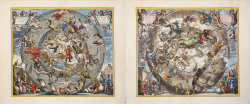
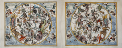
Haemisphaerium Stellatum Boreale.../ Haemisphaerium Stellatum...
Andreas CELLARIUS
Code:
S43181
Measures:
510 x 430 mm
Year:
1660 ca.
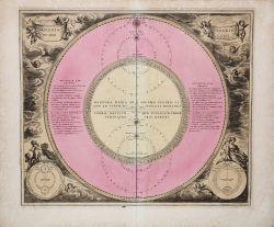
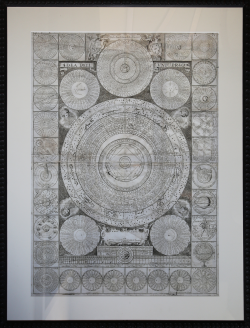
Coeli Theoria Veneris et Mercurii
Andreas CELLARIUS
Code:
W1903
Measures:
505 x 430 mm
Year:
1660 ca.
Printed:
Amsterdam
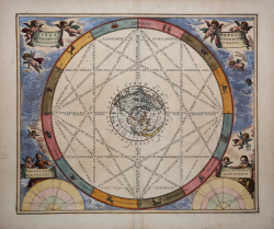
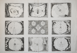
Typus Aspectuum oppositionum et coniunctionum etz in planetis
Andreas CELLARIUS
Code:
S14024
Measures:
523 x 440 mm
Year:
1660
Printed:
Amsterdam
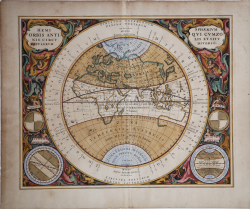
Hemisphaerium Orbis Antiqui cum Zonis, Circulis et situ popolorum...
Andreas CELLARIUS
Code:
S14023
Measures:
520 x 422 mm
Year:
1660
Printed:
Amsterdam
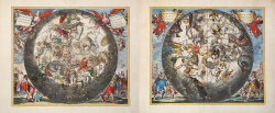
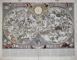
Haemisphaerium Stellatum Australe Antiquum / Haemisphaerium...
Andreas CELLARIUS
Code:
S41724
Measures:
510 x 430 mm
Year:
1660 ca.
Printed:
Amsterdam
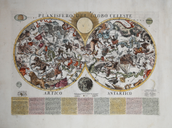
Planisfero del Globo Celeste
Francesco BRUNACCI
Code:
S28905
Measures:
565 x 425 mm
Year:
1687
Printed:
Rome
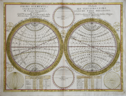
Primi Elementi, ò Introdutione Al Corso Geografico, Dal P....
Vincenzo CORONELLI
Code:
S36821
Measures:
615 x 460 mm
Year:
1690 ca.
Printed:
Venice
Idea dell'Universo
Vincenzo CORONELLI
Code:
S49147
Measures:
540 x 775 mm
Year:
1693 ca.
Printed:
Venice
Moti della Terra secondo Copernico / Ragioni di Copernico sopra il...
Vincenzo CORONELLI
Code:
S40058
Measures:
700 x 482 mm
Year:
1693 ca.
Printed:
Venice
Planisfero del Globo Celeste Artico Antartico
Paolo PETRINI
Code:
S40328
Measures:
560 x 400 mm
Year:
1700 ca.
Printed:
Naples
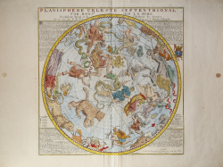
Planisphere Celeste Septentrional
Gabriel Philippe de La Hire
Code:
S48064
Measures:
465 x 475 mm
Year:
1705 ca.
Printed:
Paris
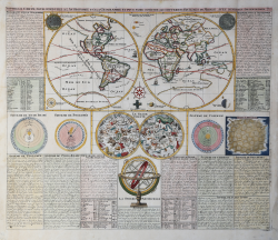
Nouvelle Carte Pour Conduire a l'Astronomie et à la Geographie et...
Henri Abraham CHATELAIN
Code:
S43053
Measures:
605 x 510 mm
Year:
1719 ca.
Printed:
Amsterdam
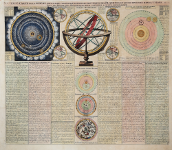
Nouvelle Carte de la Sphere pour faire connoitre les divers...
Henri Abraham CHATELAIN
Code:
S43052
Measures:
605 x 520 mm
Year:
1719 ca.
Printed:
Amsterdam
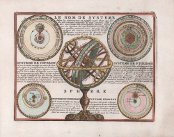
Le Nom de Systeme… / Systeme de Copernic / Systeme de Ptolomée /...
Jacques CHIQUET
Code:
S44384
Measures:
215 x 167 mm
Year:
1719
Printed:
Paris
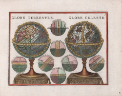
Globe Terrestre / Globe Celeste
Jacques CHIQUET
Code:
S44385
Measures:
220 x 165 mm
Year:
1719
Printed:
Paris