![[Daniel's Dream Map]](https://www.antiquarius.it/31836-home_default/daniel-s-dream-map.jpg)
[Daniel's Dream Map]
Hans LUFT
Code:
S24813
Measures:
155 x 115 mm
Year:
1534 ca.
Printed:
Wittenberg
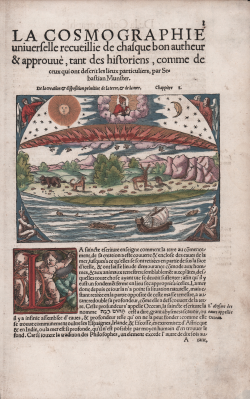
Genesis [World according to Christianity]
Sebastian Münster
Code:
S48590
Measures:
150 x 113 mm
Year:
1544 ca.
Printed:
Basle
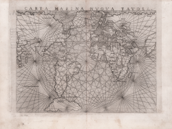
Carta Marina Nuova Tavola
Girolamo RUSCELLI
Code:
s27233
Measures:
270 x 200 mm
Year:
1561 ca.
Printed:
Venice
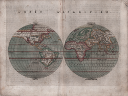
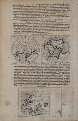
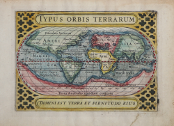
Orbis Descriptio
Girolamo RUSCELLI
Code:
ms7104
Measures:
260 x 185 mm
Year:
1561 ca.
Printed:
Venice
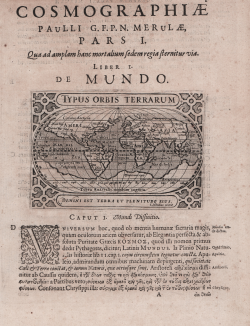
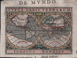
Typus Orbis Terrarum
Abraham ORTELIUS
Code:
S48046
Measures:
495 x 340 mm
Year:
1570 ca.
Printed:
Antwerpen
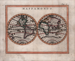
Descritione del Mappamondo
Tommaso PORCACCHI
Code:
s14005
Measures:
155 x 105 mm
Year:
1572 ca.
Printed:
Padua
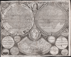
Universalis Orbis Descriptio
Giovanni MIRITI [Joannes Myritius]
Code:
s25124
Measures:
400 x 270 mm
Year:
1590
Printed:
Ingolstadt
Aevi Veteris Typus Geographicus
Abraham ORTELIUS
Code:
S299520
Measures:
450 x 320 mm
Year:
1590 ca.
Printed:
Antwerpen
Carte dei quattro continenti
Giuseppe ROSACCIO
Code:
4836
Measures:
260 x 210 mm
Year:
1590 ca.
Printed:
Venice
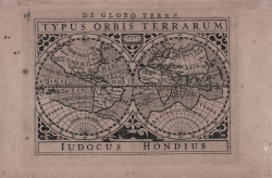
Typus Orbis Terrarum
Jodocus HONDIUS
Code:
S26992
Measures:
120 x 85 mm
Year:
1598 ca.
Printed:
Amsterdam
Totius Orbis Cogniti Universalis Descriptio
Johannes van DOETECUM
Code:
S299450
Measures:
540 x 330 mm
Year:
1605 ca.
Printed:
Antwerpen
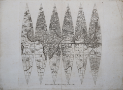
(Diversi modi per descrivere le mappe, & tavole geografiche nelle...
Johannes Baptiste VRIENTS
Code:
s27954
Measures:
500 x 390 mm
Year:
1608 ca.
Printed:
Antwerpen
Universale Descrittione di Tutto il Mondo del Ecc.te Gioseppe Rosaccio
Luigi ROSACCIO
Code:
S39294
Measures:
315 x 260 mm
Year:
1610 ca.
Typus Orbis Terrarum
Jodocus HONDIUS
Code:
S50246
Measures:
135 x 95 mm
Year:
1612
Printed:
Amsterdam
(Emisfero Orientale)
Giuseppe DE ROSSI
Code:
S34823
Measures:
325 x 327 mm
Year:
1615 ca.
Printed:
Rome
Typus Orbis Terrarum
Jodocus HONDIUS Jr.
Code:
ms2197
Measures:
140 x 95 mm
Year:
1616 ca.
Printed:
Amsterdam
Typus Orbis Terrarum
Jodocus HONDIUS Jr.
Code:
S23201
Measures:
136 x 100 mm
Year:
1616
Printed:
Amsterdam
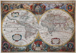
Nova Totius Terrarum Orbis Geographica Ac Hydrographica Tabula
Hendrick HONDIUS
Code:
S43997
Measures:
545 x 380 mm
Year:
1641 ca.
Printed:
Amsterdam