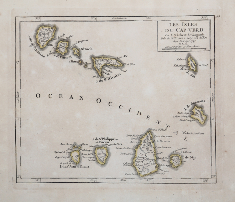
| Reference: | MS1646 |
| Author | Didier Robert de VAUGONDY |
| Year: | 1749 |
| Zone: | Cap Verde |
| Printed: | Paris |
| Measures: | 203 x 179 mm |
| Reference: | MS1646 |
| Author | Didier Robert de VAUGONDY |
| Year: | 1749 |
| Zone: | Cap Verde |
| Printed: | Paris |
| Measures: | 203 x 179 mm |
Taken from "Atlas portatif, universal et militaire" printed in Paris in 1748.
Copperplate with original outline colour, in very good conditions.
Didier Robert de VAUGONDY (1723 ca. - 1786)
|
Didier Robert de Vaugondy (1723-1786) was appointed Geographer to Louis XV in 1760. At the same time, de Vaugondy served as Geographer to the Duke of Lorraine and Bar, father-in-law to Louis XV and former King of Poland.
His major contributions to French cartography are the Atlas Universel, 1750-57, The Nouvelle Atlas Portatif (1784) and a very popular map of North America published in 1761. He was son of Gilles Robert de Vaugondy who succeeded Pierre Sanson as the King's Geographer.
|