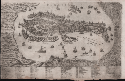
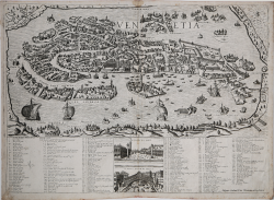
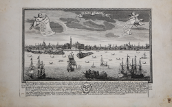
Contrafehtung der Furnemmen Statt Venedig / Sampt den umbligenden...
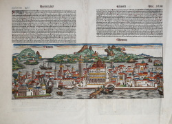
Sebastian Münster
Code:
S17408
Measures:
400 x 325 mm
Year:
1550 ca.
Printed:
Basle
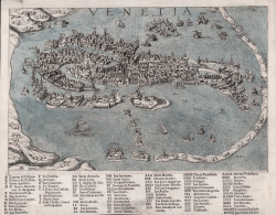
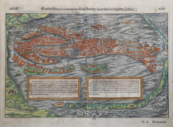
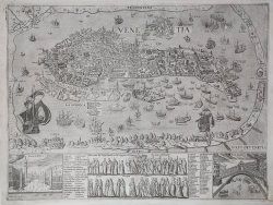
Venetia
Georg BRAUN & Franz HOGENBERG
Code:
S49238.4
Measures:
480 x 340 mm
Year:
1572 ca.
Printed:
Antwerpen & Cologne
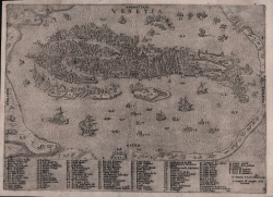
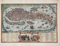
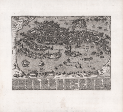
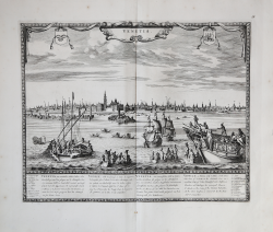
Pourtraict de la magnifique Cité de Venise
Francois de BELLEFOREST
Code:
S47351
Measures:
435 x 340 mm
Year:
1575
Printed:
Paris
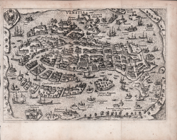
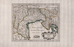
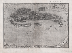
Venetiae Histriae et Carnici Agri descriptio auctore Ph. Cluuerio
Philipp CLUVER
Code:
S42546
Measures:
260 x 210 mm
Year:
1659
Printed:
Paris
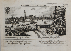
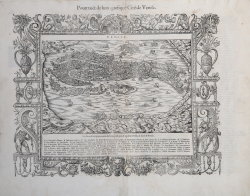
Fortunae Credere Noli. Venedig. Univers:
Daniel MEISNER
Code:
s23012
Measures:
150 x 100 mm
Year:
1678 ca.
Printed:
Nurnberg
Citta di Venetia con l'Isole che la circondano
Vincenzo CORONELLI
Code:
S40213
Measures:
431 x 280 mm
Year:
1689
Printed:
Venice
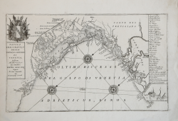
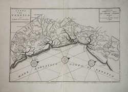
Tavola Idrografica della Città, e Contorni di Venetia, Dedicata...
Vincenzo CORONELLI
Code:
S40273
Measures:
435 x 275 mm
Year:
1689
Printed:
Venice
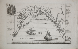
Les Environs de Venise
Pierre MORTIER
Code:
S40192
Measures:
430 x 270 mm
Year:
1704 ca.
Printed:
Amsterdam
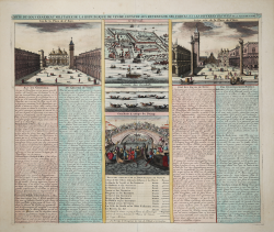
Carte du Government Militaire de La Republique de Venice l'etat de...
Henri Abraham CHATELAIN
Code:
s29440
Measures:
450 x 380 mm
Year:
1708 ca.
Printed:
Paris
Venetia / Venedia
Johann Christian LEOPOLD
Code:
S38991
Measures:
300 x 202 mm
Year:
1725 ca.
Printed:
Augsburg