
| Reference: | MS6440 |
| Author | Antonio ZATTA |
| Year: | 1778 |
| Zone: | United States |
| Printed: | Venice |
| Measures: | 1280 x 1300 mm |
| Reference: | MS6440 |
| Author | Antonio ZATTA |
| Year: | 1778 |
| Zone: | United States |
| Printed: | Venice |
| Measures: | 1280 x 1300 mm |
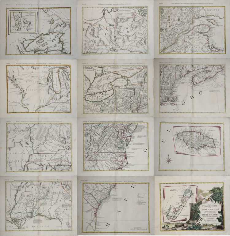
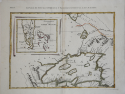
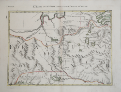
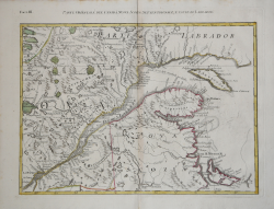
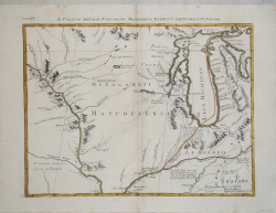
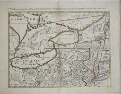
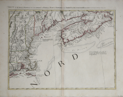
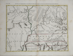
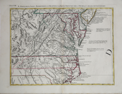
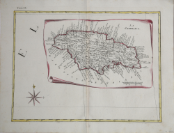
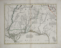
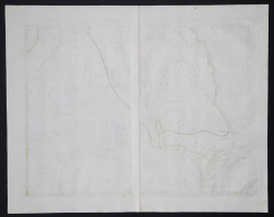
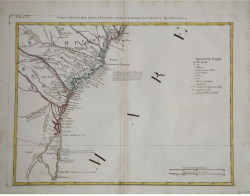
Geographic wall map, made of 12 sheets yet to be joined together. Taken from Zatta’s Atlante Novissimo published in Venice between 1779 and 1785. The map is based on J. Mitchell’s, which was used to establish the borders of the colonies during the peace treaty of Paris in 1783, after the Independence War, becoming henceforth the first, official map of the United States.
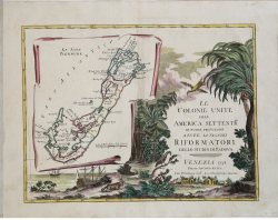
Zatta’s map is the first, Italian edition of this legendary map; it has been realized in the characteristic eighteenth-century Venetian style, including also a cartouche depicting the map of the Bermuda Islands. Nevertheless, the map of Zatta differs quite a lot from its prototype for it shows many geographic details which were inferred from other cartographic sources.
For instance, the State of Virginia derives from the 1753 map of Fry and Jefferson, while around the cities of Saratoga, Philadelphia and Charleston there are some information about the independence war. Noteworthy is also the fact that this is one of the first maps to define the British colonies the “United Colonies”.
Map from the Atlante novissimo, illustrato ed accresciuto sulle osservazioni e scoperte fatte dai più celebri e più recenti geografi. Printed in four volumes by Antonio Zatta between 1779 and 1785.
Atlas among the most beautiful and complete ever published in Italy in the eighteenth century, the most famous work of Zatta.
The Atlante Novissimo, as also specified in the title, is “increased on the observations made by the most famous and most recent geographers”. Among the most significant innovations there is the appearance of the new islands discovered in the Pacific Ocean by James Cook and the first Italian map of New Zealand. The illustrations were designed and drawn by his collaborators Giovanni Marco Pitteri, Anton Friedrich Busching, Pietro Antonio Novelli and engraved by Giuliano Zuliani.
The first volume of the atlas is introduced by a brief essay of general geography where the author defines in a concise and precise way the elements that make up the ecliptic and equatorial grids used in the tables. Interesting is the section where he pauses to describe the phenomenon of precession of the equinoxes and the cyclical variation of the obliquity of the ecliptic.
Etching, printed on contemporary laid paper, contemporary outline coloring, in good condition.
|
Sabin 68109; Stephenson, A la Carte, p. 113; cf P 650, 651. Map Forum 1, p. 58.
|
Antonio ZATTA (Venezia 1722 - 1804)
|
Antonio Zatta (1775-1797) was the most prominent Italian map publisher of the late 18th and early 19th century. His firm, based in Venice, produced maps that mark an important transition from 18th to 19th century cartographic styles. He updates and redefines the traditional title cartouche by replacing the mythic elements common to the 17th and 18th century with more representative images of Venice. His most important work is the four volume Atlante novissimo published from 1775 to 1789.
|
|
Sabin 68109; Stephenson, A la Carte, p. 113; cf P 650, 651. Map Forum 1, p. 58.
|
Antonio ZATTA (Venezia 1722 - 1804)
|
Antonio Zatta (1775-1797) was the most prominent Italian map publisher of the late 18th and early 19th century. His firm, based in Venice, produced maps that mark an important transition from 18th to 19th century cartographic styles. He updates and redefines the traditional title cartouche by replacing the mythic elements common to the 17th and 18th century with more representative images of Venice. His most important work is the four volume Atlante novissimo published from 1775 to 1789.
|