| Reference: | IT3398 |
| Author | Giuseppe MOROZZO DELLA ROCCA |
| Year: | 1791 |
| Zone: | Latium |
| Printed: | Rome |
| Measures: | 1160 x 800 mm |
| Reference: | IT3398 |
| Author | Giuseppe MOROZZO DELLA ROCCA |
| Year: | 1791 |
| Zone: | Latium |
| Printed: | Rome |
| Measures: | 1160 x 800 mm |
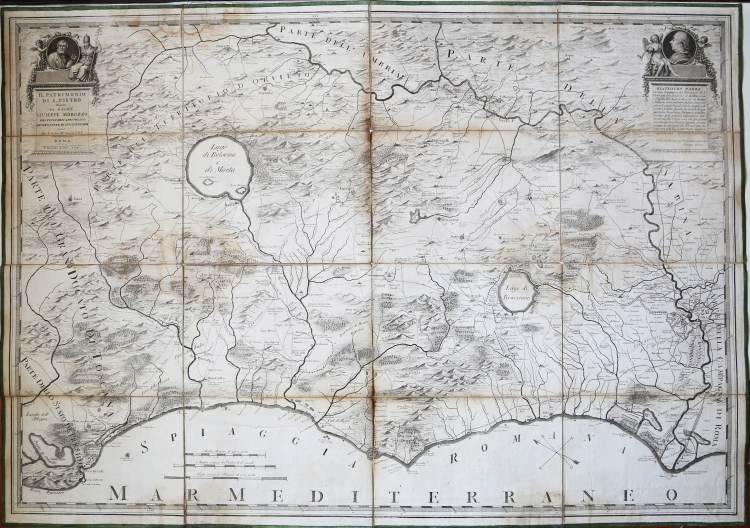
Great wall map depicting the northern part of the region, between mount Argentario and the mouth of the Tiber, engraved by Cassini and printed in 1791. Full of details, the map has been laid on old canvas, folded many times, and put in a contemporary case. Copper engraving, light water stain, otherwise in excellent condition.
|
Istituto di Studi Romani, a cura di A. Frutaz, "Le Carte del Lazio", XLV.a tav. 211
|
Giuseppe MOROZZO DELLA ROCCA(Torino, 12 marzo 1758 – Novara, 22 marzo 1842)
|
Istituto di Studi Romani, a cura di A. Frutaz, "Le Carte del Lazio", XLV.a tav. 211
|
Giuseppe MOROZZO DELLA ROCCA(Torino, 12 marzo 1758 – Novara, 22 marzo 1842)