| Reference: | CO-188 |
| Author | Pieter VANDER AA |
| Year: | 1714 ca. |
| Zone: | Toscana |
| Printed: | Leyden |
| Measures: | 305 x 230 mm |
| Reference: | CO-188 |
| Author | Pieter VANDER AA |
| Year: | 1714 ca. |
| Zone: | Toscana |
| Printed: | Leyden |
| Measures: | 305 x 230 mm |
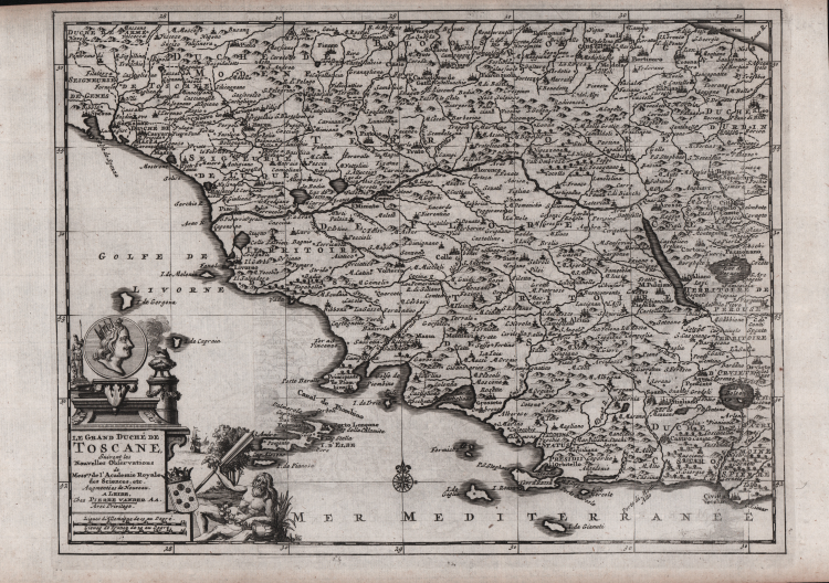
Uncommon and detailed map of Tuscia and its mainland, from Nouvelle atlas, trés-exact et fort commode pour toutes sortes de personnes, contenant les principales cartes géographique printed in Leiden 1714. Decorative cartouche
Etching, good condition.
Pieter VANDER AA (1659 - 1733)
|
Records show that van der Aa, born in Leyden in 1659, made an early start in life by being apprenticed to a bookseller at the age of nine and starting on his own in business as a book publisher by the time he was twenty-three.
During the following fifty years he published an enormous amount of material, including atlases and illustrated works in every shape and size, two of them consisting of no less than 27 and 28 volumes containing over 3,000 maps and plates.
Most of his maps were not of the first quality and were certainly not original, but they are often very decorative and are collected on that account.
|