Tabula VIII Europae Laurent FRIES Code: S38210 Measures: 560 x 415 mm Year: 1522 Printed: Strasbourg Price €1,100.00 Quick view View Details
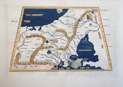
Tabula Secunda Asiae Laurent FRIES Code: S39979 Measures: 515 x 385 mm Year: 1522 ca. Printed: Vienne Price €475.00 Quick view View Details
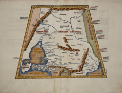
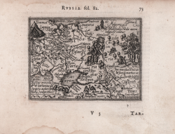
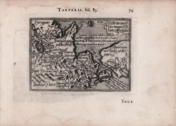
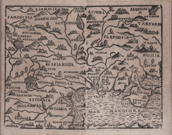
Tartaria olim Scythia Sebastian Münster Code: MS6338 Measures: 160 x 255 mm Year: 1550 ca. Price €180.00 Quick view View Details
Riga Sebastian Münster Code: S48033 Measures: 155 x 100 mm Year: 1552 Printed: Basle Price €180.00 Quick view View Details
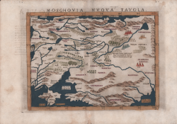
Moscovia Nuova Tavola Girolamo RUSCELLI Code: ms3554 Measures: 265 x 190 mm Year: 1561 ca. Printed: Venice Price €325.00 Quick view View Details
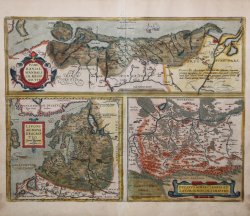
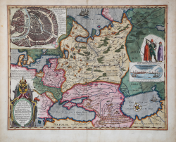
Pomeraniae, Wandalicae Regionis, Typ. & Livoniae Nova Descriptio &... Abraham ORTELIUS Code: S46123 Measures: 505 x 385 mm Year: 1570 ca. Printed: Antwerpen Price €575.00 Quick view View Details
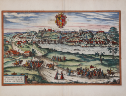
Vera Designatio Urbis In Littavia Grodnae Georg BRAUN & Franz HOGENBERG Code: S49238.48 Measures: 480 x 305 mm Year: 1575 ca. Printed: Antwerpen & Cologne Price €850.00 Quick view View Details
Russiae moscovia et tartariae descriptio Abraham ORTELIUS - Philip GALLE Code: S33915 Measures: 110 x 80 mm Year: 1577 Printed: Antwerpen Price €250.00 Quick view View Details
Tartariae sive magni Chamu regni typus Abraham ORTELIUS - Philip GALLE Code: S33916 Measures: 110 x 80 mm Year: 1577 Printed: Antwerpen Price €250.00 Quick view View Details
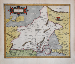
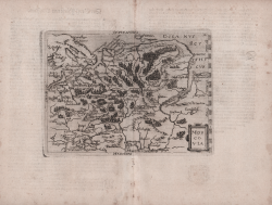
EUR: VIII TAB: (Europae Tabula Octava) Gerard MERCATOR (Kremer) Code: s34891 Measures: 436 x 347 mm Year: 1578 ca. Printed: Cologne Price €700.00 Quick view View Details
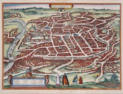
Vilna Lituaniae Metropolis Georg BRAUN & Franz HOGENBERG Code: S49238.7 Measures: 500 x 365 mm Year: 1581 ca. Printed: Antwerpen & Cologne Price €2,800.00 Quick view View Details
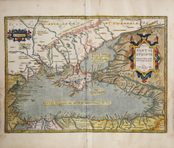
PONTOS EUKSEINOS. PONTUS EUXINUS. Æquor Iasonis pulsatum remige... Abraham ORTELIUS Code: S46098 Measures: 500 x 355 mm Year: 1590 ca. Printed: Antwerpen Price €750.00 Quick view View Details
(Europa Orientale) Giuseppe ROSACCIO Code: mms2751 Measures: 65 x 130 mm Year: 1594 ca. Printed: Venice Price €450.00 Quick view View Details
Moscovia Giovanni BOTERO Code: S26748 Measures: 210 x 160 mm Year: 1596 Printed: Cologne Price €1,000.00 Quick view View Details
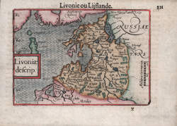
Livoniae descrip. Barent LANGENES Code: S50569 Measures: 125 x 90 mm Year: 1598 ca. Printed: Amsterdam Price €250.00 Quick view View Details
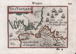
Ins. Vaygats Barent LANGENES Code: S50675 Measures: 125 x 85 mm Year: 1598 ca. Printed: Amsterdam Price €200.00 Quick view View Details
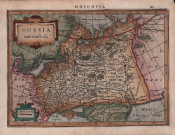
Russia cum Confinijs Jodocus HONDIUS Code: S41380 Measures: 200 x 145 mm Year: 1607 ca. Printed: Amsterdam Price €200.00 Quick view View Details
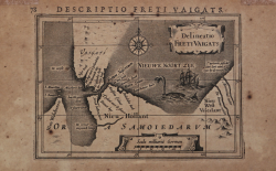
Delineato Freti Vaigats Jodocus HONDIUS Jr. Code: MS1820 Measures: 135 x 95 mm Year: 1612 ca. Printed: Amsterdam Price €180.00 Quick view View Details
Tabula Russiae ex autographo, quod delineandum curavit Foedor... Hessel GERRITSZ Code: S33901 Measures: 575 x 480 mm Year: 1613 ca. Printed: Amsterdam Price Not Available Quick view View Details
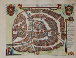
Moscovia Urbs Metropolis Totius Russiae Albae Georg BRAUN & Franz HOGENBERG Code: S49238.3 Measures: 460 x 350 mm Year: 1617 ca. Printed: Antwerpen & Cologne Price €5,000.00 Quick view View Details