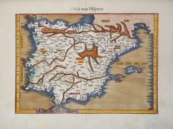
Tabula nova Hispaniae Laurent FRIES Code: S43123 Measures: 425 x 300 mm Year: 1522 ca. Printed: Vienne Price €875.00 Quick view View Details
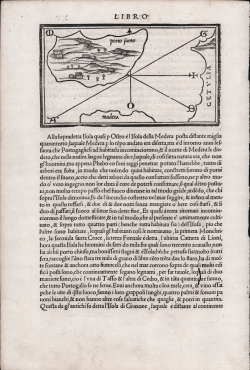
(Porto Santo) Benedetto BORDONE Code: S16989 Measures: 200 x 300 mm Year: 1528 ca. Printed: Venice Price €125.00 Quick view View Details
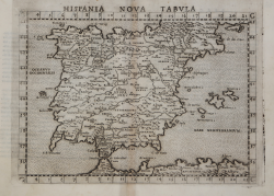
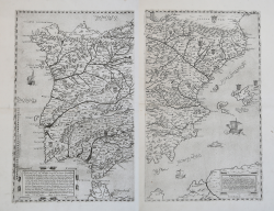
Hispania Nova Tabula Girolamo RUSCELLI Code: ms7994 Measures: 260 x 280 mm Year: 1561 Printed: Venice Price €300.00 Quick view View Details
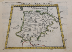
Tabula Europae II Girolamo RUSCELLI Code: s28377 Measures: 270 x 190 mm Year: 1561 ca. Printed: Venice Price €275.00 Quick view View Details
Al Molto Mag.o et Ecc. Alessandro Serego. Che lo studio della... Paolo FORLANI Code: S30347 Measures: 445 x 560 mm Year: 1567 ca. Printed: Venice Price €10,000.00 Quick view View Details
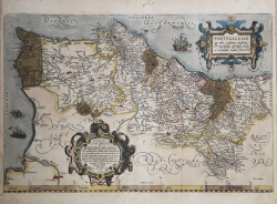
Portugalliae que olim Lusitania novissima.. Abraham ORTELIUS Code: MMS1232 Measures: 515 x 345 mm Year: 1570 ca. Printed: Antwerpen Price €700.00 Quick view View Details
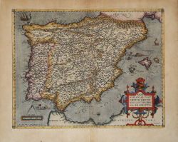
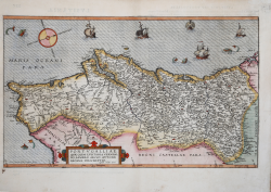
Regni Hispaniae Postomnivm Editiones Locvpletissima Descriptio Abraham ORTELIUS Code: S27334 Measures: 500 x 380 mm Year: 1570 ca. Printed: Antwerpen Price €600.00 Quick view View Details
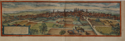
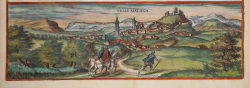
Vallisoletum Georg BRAUN & Franz HOGENBERG Code: S40001 Measures: 480 x 140 mm Year: 1572 Printed: Antwerpen & Cologne Price €225.00 Quick view View Details
Burgos, celebris et antiqua Hispaniae civitas... / Sanct.... Georg BRAUN & Franz HOGENBERG Code: S49238.91 Measures: 475 x 330 mm Year: 1572 ca. Printed: Antwerpen & Cologne Price €600.00 Quick view View Details New
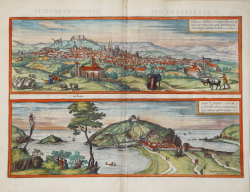
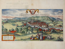
Toletum / Vallisoletum Georg BRAUN & Franz HOGENBERG Code: S49238.89 Measures: 475 x 335 mm Year: 1572 ca. Printed: Antwerpen & Cologne Price €700.00 Quick view View Details New
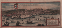
Lisbona Georg BRAUN & Franz HOGENBERG Code: S39999 Measures: 500 x 230 mm Year: 1572 Printed: Antwerpen Price €600.00 Quick view View Details
Velis Malaga Georg BRAUN & Franz HOGENBERG Code: S40005 Measures: 490 x 165 mm Year: 1575 Printed: Antwerpen & Cologne Price €200.00 Quick view View Details
Bilvao. En, Spectator Benevole, Magnifica Hispaniae Civitas Bilbao ... Georg BRAUN & Franz HOGENBERG Code: S49238.47 Measures: 485 x 255 mm Year: 1575 ca. Printed: Antwerpen & Cologne Price €900.00 Quick view View Details New
Portugallia e quae olim Lusitania Vernando Alvaro Secco Autore... Gerard DE JODE Code: MS2641 Measures: 520 x 300 mm Year: 1578 Printed: Antwerpen Price €2,000.00 Quick view View Details
Sevilla Georg BRAUN & Franz HOGENBERG Code: S49238.32 Measures: 480 x 360 mm Year: 1588 ca. Printed: Antwerpen & Cologne Price €1,100.00 Quick view View Details New
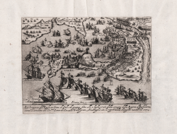
La Impresa del Isola et Citta di Calis di spagna fatta alli 2... Giacomo FRANCO Code: S40844 Measures: 220 x 165 mm Year: 1596 ca. Price €500.00 Quick view View Details
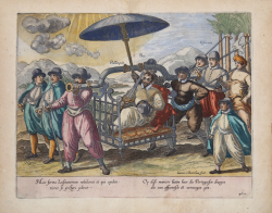
Hac forma Lusitanorum nobiliores et qui opulen tiores se gestari... Jan Huygen van LINSCHOTEN Code: MS6368 Measures: 320 x 255 mm Year: 1596 ca. Printed: Amsterdam Price €250.00 Quick view View Details
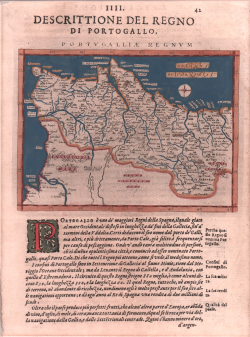
Portugalliae Regnum Giovanni Antonio MAGINI Code: S103650 Measures: 180 x 140 mm Year: 1596 Printed: Venice Price €200.00 Quick view View Details
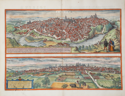
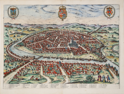
Granata Georg BRAUN & Franz HOGENBERG Code: S49238.90 Measures: 500 x 375 mm Year: 1596 ca. Printed: Antwerpen & Cologne Price €800.00 Quick view View Details New
Nova Bracarae Auguste descriptio Georg BRAUN & Franz HOGENBERG Code: S49238.162 Measures: 500 x 365 mm Year: 1596 ca. Printed: Antwerpen & Cologne Price €750.00 Quick view View Details New