
| Reference: | S45892 |
| Author | Jean Baptiste Bourguignon D'Anville |
| Year: | 1739 |
| Zone: | Central & Southern Italy |
| Printed: | Paris |
| Measures: | 450 x 260 mm |
| Reference: | S45892 |
| Author | Jean Baptiste Bourguignon D'Anville |
| Year: | 1739 |
| Zone: | Central & Southern Italy |
| Printed: | Paris |
| Measures: | 450 x 260 mm |
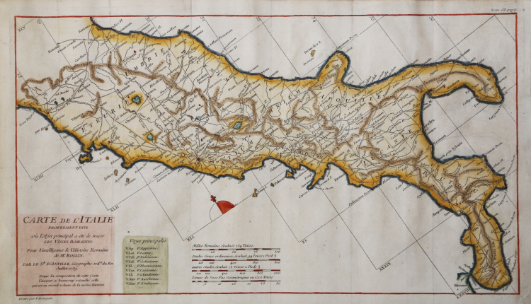
Carta geografica della Italia centro-meridionale disegnata da Jean-Baptiste Bourguignon D'anville per la Storia romana del Rollin.
Histoire romaine depuis la fondation de Rome jusqu'à la bataille d'Actium di Charles Rollin divenne una tra le opere più durature dedicate alla storia romana, impreziosita da alcune carte geografiche esplicative, che furono anche parte dell'Atlas de géographie ancienne pour servir à l'intelligence des oeuvres de Rollin: gravé d'après les cartes originales de d'Anville.
Acquaforte, finemente colorata a mano, in ottimo stato di conservazione.
Jean Baptiste Bourguignon D'Anville (1697-1782)
|
Jean Baptiste Bourguignon d'Anville was perhaps the most important and prolific cartographer of the 18th century. D'Anville's passion for cartography manifested during his school years when he amused himself by composing maps for Latin texts. There is a preserved manuscript dating to 1712, Graecia Vetus, which may be his earliest surviving map - he was only 15 when he drew it. He would retain an interest in the cartography of antiquity throughout his long career and published numerous atlases to focusing on the ancient world. At twenty-two D'Anville, sponsored by the Duke of Orleans, was appointed Geographer to the King of France. As both a cartographer and a geographer, he instituted a reform in the general practice of cartography. Unlike most period cartographers, D'Anville did not rely exclusively on earlier maps to inform his work, rather he based his maps on intense study and research. His maps were thus the most accurate and comprehensive of his period - truly the first modern maps.
|