| Reference: | S9683 |
| Author | Reiner & Joshua OTTENS |
| Year: | 1725 ca. |
| Zone: | Padova |
| Printed: | Amsterdam |
| Measures: | 450 x 390 mm |
| Reference: | S9683 |
| Author | Reiner & Joshua OTTENS |
| Year: | 1725 ca. |
| Zone: | Padova |
| Printed: | Amsterdam |
| Measures: | 450 x 390 mm |
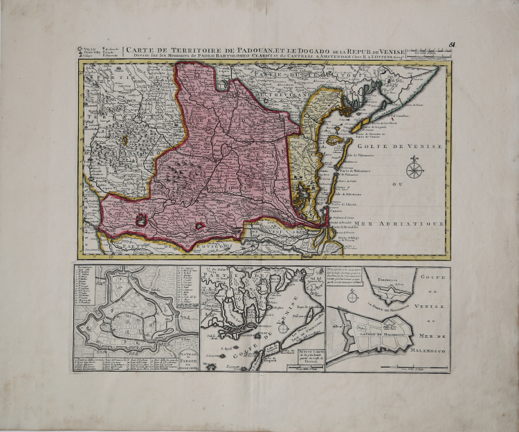
The workshop founded by Joachim Ottens (1663 – 1719), lived its golden age between 1720 and 1750, directed by his sons Reiner (1698 -1750)and Joshua (1704 – 1765). The production of the workshop is massive; it includes also all the maps that ahd ever been realized until then, with 800 plates collected in 15 atlases. The maps are characterized by the fact that they are all hand coloured, but they are quire rare to be found. The following group is taken from the Atlas Maior, published around 1730.
Copper engraving, fine contemporary hand colour, wide margins in excellent condition. Rare.
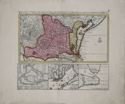
Map depicting the territories of Padua and Venice, decorated with three cartouches on lower part with the city plan of Padua, a detail of the Lagoon and the fort of Malamocco. The map derives from those realized by Bartolomeo Clarici and by Giacomo Cantelli.
|
Tooley p. 479.
|
|
The family business of print and map selling was founded by Joachim Ottens but the active period of map publishing was concentrated in the years between 1720 and 1750 when the brothers, Reiner and Joshua, produced enormous collections of maps, some as large as 15 volumes.
These, including copies of practically all maps available at the time, were made up to order and were magnificently coloured. Besides these specially prepared collections they also issued single-volume atlases with varying contents as well as pocket atlases.
|
|
Tooley p. 479.
|
|
The family business of print and map selling was founded by Joachim Ottens but the active period of map publishing was concentrated in the years between 1720 and 1750 when the brothers, Reiner and Joshua, produced enormous collections of maps, some as large as 15 volumes.
These, including copies of practically all maps available at the time, were made up to order and were magnificently coloured. Besides these specially prepared collections they also issued single-volume atlases with varying contents as well as pocket atlases.
|