| Reference: | MS1210 |
| Author | Henri Abraham CHATELAIN |
| Year: | 1708 |
| Zone: | Copenhagen |
| Printed: | Amsterdam |
| Measures: | 460 x 380 mm |
| Reference: | MS1210 |
| Author | Henri Abraham CHATELAIN |
| Year: | 1708 |
| Zone: | Copenhagen |
| Printed: | Amsterdam |
| Measures: | 460 x 380 mm |
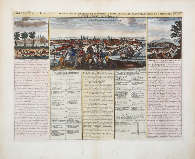
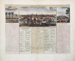
Wonderful view of Copenhagen and, on either side of the view, small engravings of Friderichsbourg and of the Vue de Bergue.
This highly detailed plate provides a detailed account of Swedish history, including a description of the political, religious, and military infrastructure.
The top section of the sheet includes three stunning city views, with a wonderful panorama of Stockholm. On either side of the view of Stockholm are small engravings of the Chateau of Yacobdal and the Royal Palace.
The bottom section of the sheet is filled with various tables listing the social, political, religious, and military structure of Sweden.
Henri Abraham Chatelain (1684 - 1743) was a Huguenot pastor of Parisian origins. He is best known as a Dutch cartographer and more specifically for his cartographic contribution in the seminal seven volume Atlas Historique, published in Amsterdam between 1705 and 1720. Innovative for its time, the Atlas Historique combined fine engraving and artwork with scholarly studies of geography, history, ethnology, heraldry, and cosmography. Some scholarship suggests that the Atlas Historique was not exclusively compiled by Henri Chatelain, as is commonly believed, but rather was a family enterprise involving Henri, his father Zacharie and his brother, also Zacharie.
Etching with fine later hand colour, very good condition.
Henri Abraham CHATELAIN (1684 - 1743)
|
Henri Abraham Chatelain (1684 - 1743) was a Huguenot pastor of Parisian origins. He is best known as a Dutch cartographer and more specifically for his cartographic contribution in the seminal seven volume Atlas Historique, published in Amsterdam between 1705 and 1720. Innovative for its time, the Atlas Historique combined fine engraving and artwork with scholarly studies of geography, history, ethnology, heraldry, and cosmography. Some scholarship suggests that the Atlas Historique was not exclusively compiled by Henri Chatelain, as is commonly believed, but rather was a family enterprise involving Henri, his father Zacharie and his brother, also Zacharie. The Atlas Historique published by Chatelain was part of a major work of its time, an encyclopaedia in seven volumes including geography as one of its main subjectes. The text was by Nicholas Gueudeville and the maps by Chatelain. The Atlas included one of the finest maps of America (4 sheets) surrounded by vignettes and decorative insets.
1705-20 Atlas Historique:Amsterdam (maps by Chatelain based on G.Delisle)
Further issues to 1739
|