| Reference: | S42871 |
| Author | Anonimo |
| Year: | 1747 |
| Zone: | Genova |
| Printed: | Wien |
| Measures: | 375 x 255 mm |
| Reference: | S42871 |
| Author | Anonimo |
| Year: | 1747 |
| Zone: | Genova |
| Printed: | Wien |
| Measures: | 375 x 255 mm |
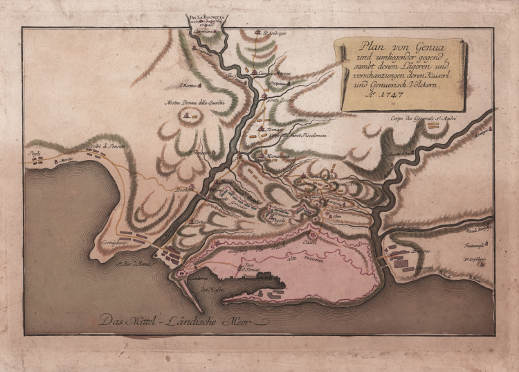
Anon and rare historical-geographic map showing the places occupied by the Austrian Imperial Army on April 16, 1747, during the siege of Genoa.
The map shows in outline only the walls of the city, and the positions of the besieging troops concentrated in the hinterland, principally between the rivers Polsevera and Bisagno. The Austrians had previously captured Genoa, but had been expelled from it in December 1746 by a revolt of the inhabitants. The second attempt by the Austrians, commanded by Count Schulenberg, to take the city by siege, which began in April 1747, was abandoned after the arrival of their Sardinian allies, commanded by General Pallavicini, in June, in the face of the advent of a strong French relief force under the command of Marshal Belle-Isle and General Las Minas.
Etching, printed on contemporary laid paper, fine original colouring, good condition. A very rare work.
Anonimo
Anonimo