| Reference: | S37841 |
| Author | Istituito Geografico WEIMAR |
| Year: | 1804 |
| Zone: | Italy |
| Printed: | Weimar |
| Measures: | 489 x 558 mm |
| Reference: | S37841 |
| Author | Istituito Geografico WEIMAR |
| Year: | 1804 |
| Zone: | Italy |
| Printed: | Weimar |
| Measures: | 489 x 558 mm |
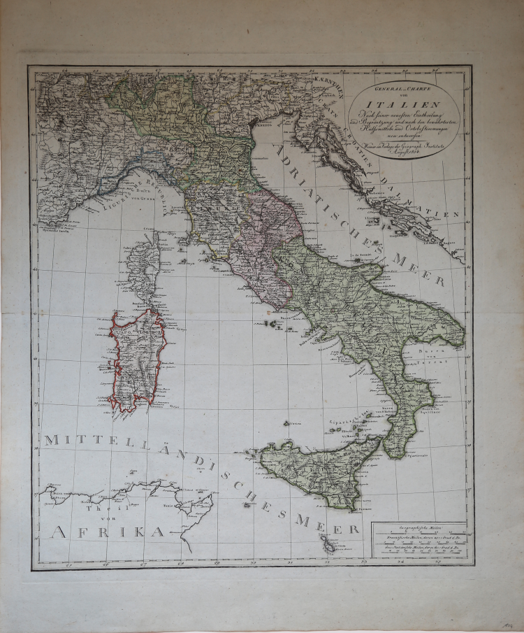
Map of Italy with administrative and political divisions.
Relief shown by hachures. Shows regioni, city, countries, rivers and mountains.
Regions coloring with different colors, title cartouche at the top right. Bottom, on the same side, milestone.
In excellent condition.
|
Founded by friecrich Justin Bertuch in 1804 in Weimar, to engrave, print and publish both domestic and foreign geographical and cartographical publications including shool atlases, historical atlases, regional, world and special atlases. The Institut took over the publication of many of the maps first created and published by the Landes-Industrie Comptoir. Many important mapmakers worked for the company including: Gussefeld, August and Adolf Stieler, Heirich Hiepert ecc.
|
|
Founded by friecrich Justin Bertuch in 1804 in Weimar, to engrave, print and publish both domestic and foreign geographical and cartographical publications including shool atlases, historical atlases, regional, world and special atlases. The Institut took over the publication of many of the maps first created and published by the Landes-Industrie Comptoir. Many important mapmakers worked for the company including: Gussefeld, August and Adolf Stieler, Heirich Hiepert ecc.
|