- New
| Reference: | S52517 |
| Author | Pieter VANDER AA |
| Year: | 1713 ca. |
| Zone: | Italy |
| Printed: | Leyda |
| Measures: | 385 x 260 mm |
| Reference: | S52517 |
| Author | Pieter VANDER AA |
| Year: | 1713 ca. |
| Zone: | Italy |
| Printed: | Leyda |
| Measures: | 385 x 260 mm |
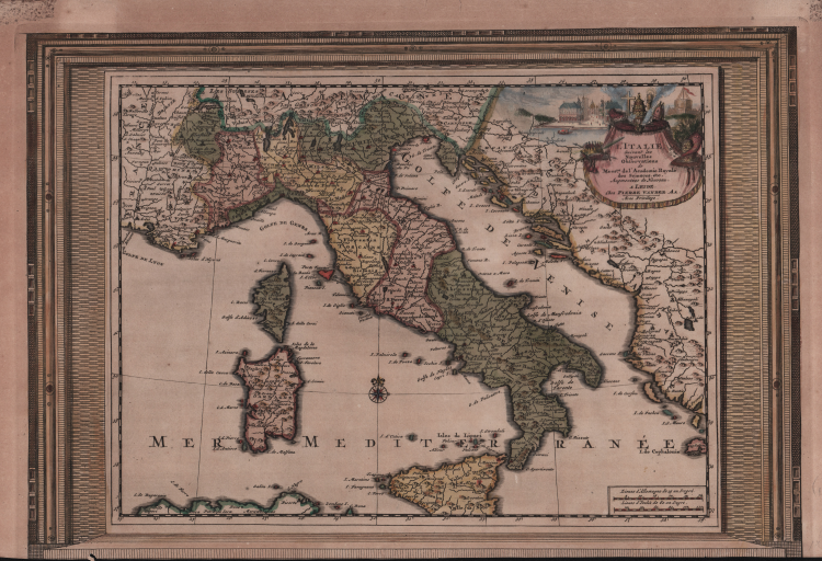
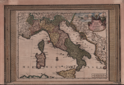
La carta è racchiusa in una cornice decorativa. Era parte della Galerie Agreable du Monde, il famoso atlante di Vander Aa, completato nel 1729 e consistente in più di 3000 mappe.
La carta è pubblicata, per la prima volta, in Le Nouveau Theatre du Monde, ou la Geo- graphie Royale, Composée De Nouvelle Cartes Tres-Exactes, Dres- sées sue les Observations de Messieurs de l'Academie des Sciences à Paris. Avec une Description Geographique Et Historique Des Quatres Parties de L'Univers, Desquelles L'Europe en detail est écrite Par Mr. Gueudeville. & les trois autres Par Mr. Ferrarius A Leide, Chez Pierre van der Aa, Marchand Libraire. MDCCXIII. Il volume si compone di 95 mappe composte due a due su ogni foglio. Il volume è dedicato a Francesco Cornaro, figlio primogenito del Doge Giovanni Cornaro (1647-1722), eletto nel 1709.
Acquaforte, finemente colorata a mano in epoca, in ottimo stato di conservazione. Rara.
Pieter VANDER AA (1659 - 1733)
|
Records show that van der Aa, born in Leyden in 1659, made an early start in life by being apprenticed to a bookseller at the age of nine and starting on his own in business as a book publisher by the time he was twenty-three.
During the following fifty years he published an enormous amount of material, including atlases and illustrated works in every shape and size, two of them consisting of no less than 27 and 28 volumes containing over 3,000 maps and plates.
Most of his maps were not of the first quality and were certainly not original, but they are often very decorative and are collected on that account.
|