| Reference: | S4995 |
| Author | Jacob SAVERY |
| Year: | 1648 ca. |
| Zone: | The Holy Land |
| Printed: | Amsterdam |
| Measures: | 485 x 322 mm |
| Reference: | S4995 |
| Author | Jacob SAVERY |
| Year: | 1648 ca. |
| Zone: | The Holy Land |
| Printed: | Amsterdam |
| Measures: | 485 x 322 mm |
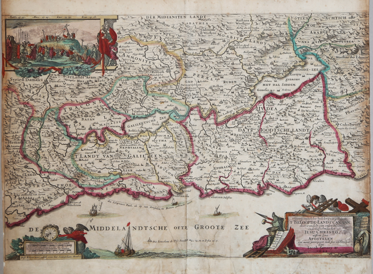
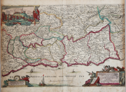
Geographische Beschryvinge van t'Beloofde-Landt Canaan, door Wandelt van onsen Heere ende Salichmaecker Iesu Christo nessens syne Apostelen van nieus gecorigeert ende seer verbetert door Iacob Savery Ao 1648.
This is a decorative map of the Holy Land attributed to Jacob Savery III in 1648. The grandson of a popular Dutch artist, Savery likely based the image on a similar map issued in 1642 by Visscher. Like many 16th and 17th century Bible maps, it shows various places and events prominently featured in the New Testament. A few examples include Jesus walking on water in the Sea of Galilee, Paul’s travels in the Mediterranean, and Sodom and Gomorrah submerged in the Dead Sea.
A decorative title cartouche is surrounded by implements used in the crucifixion, with putties holding aloft a ladder. Opposite the cartouche is a decorative compass rose, showing the orientation of the map with west at the top. Between the two can be seen the symbol for identifying the six Cities of Refuge, where perpetrators of certain crimes could claim asylum. An inset view of Cavalry and the crucifixion of Christ can be seen in the upper left, with Mary, mother of James and Joseph, looking away
Etching with fine original colouring, good condition.
Jacob SAVERY (Kortrijk, 1566 – Amsterdam, 1603)
|
Dutch Golden Age painter.
According to Van Mander in 1604, he was the best pupil of Hans Bol and taught his brother Roelant Savery and Frans de Grebber, then a promising young painter and tapestry worker in Haarlem, how to paint landscapes. He died of the plague in Amsterdam. According to Houbraken, who wrote a biography on his brother Roelant Savery (more famous because he painted for the court in Prague), Jacob was his father, and taught him to paint animals and fish, but Jacob was his older brother, not his father.
According to the RKD he worked in Haarlem from 1584–1589, before moving to Amsterdam. He was the teacher of Joos Goemare, his brother, Frans de Grebber, and Willem van Nieulandt II. He was the son of Maarten Savery, brother of Roelant and Hans I, father of Jan Savery, Jacob II, Salomon, and Maria. Through daughter Maria, he was the grandfather of the painters Geertruyd, Roelant Roghman, and Magdalena Roghman.
|